If not for having some extra time between our drive from the Great Sand Dunes to Santa Fe and a lot of things being closed due to Covid, we would’ve nearly skipped Bandelier. But since we had time, we took a bit of an extra detour to go to this small but very unique national monument and had a lovely afternoon strolling through this quiet but amazing place.
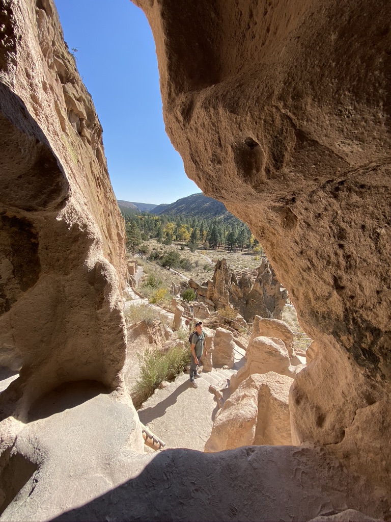
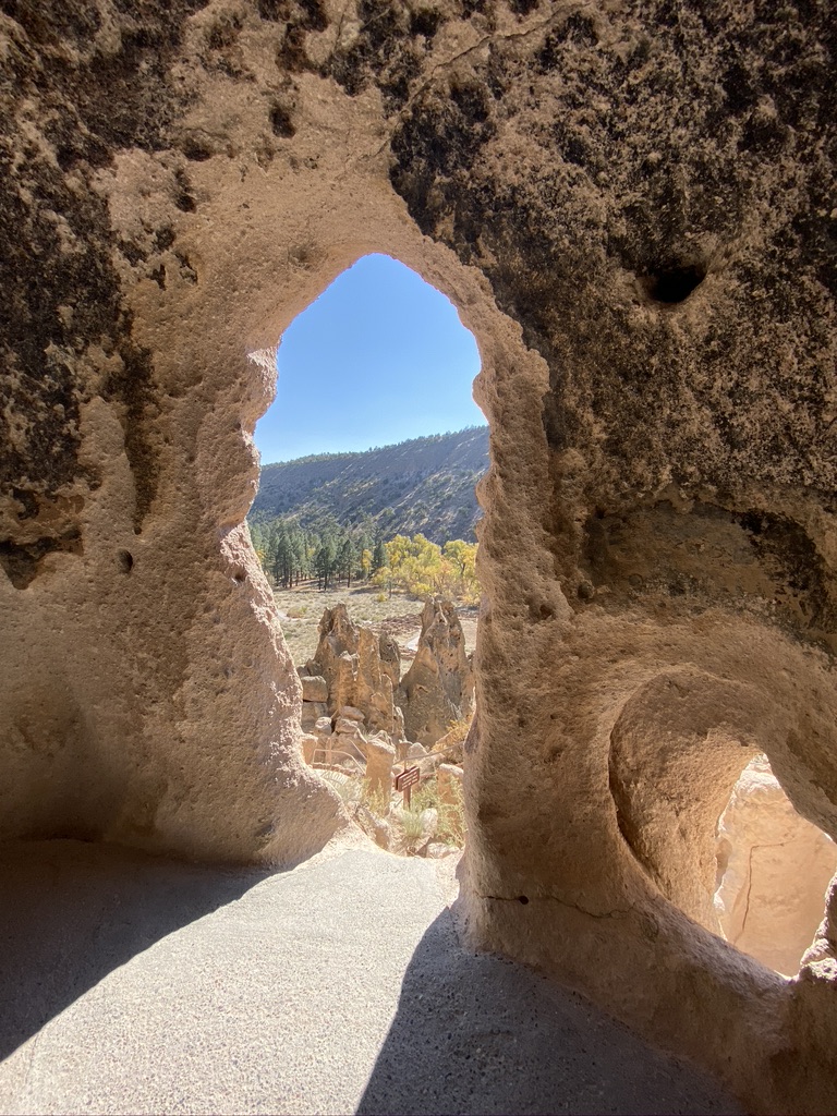
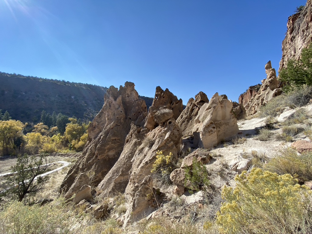
Bandelier basically had one main loop trail that took us up to various cave dwellings and ruins of sites once inhabited by the Ancestral Pueblo people. Since we weren’t able to visit the cliff dwellings at Mesa Verde due to Covid, we were really excited to get to climb the ladders and look at the dwellings here up close.
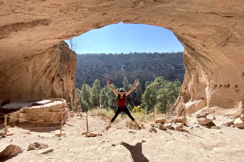
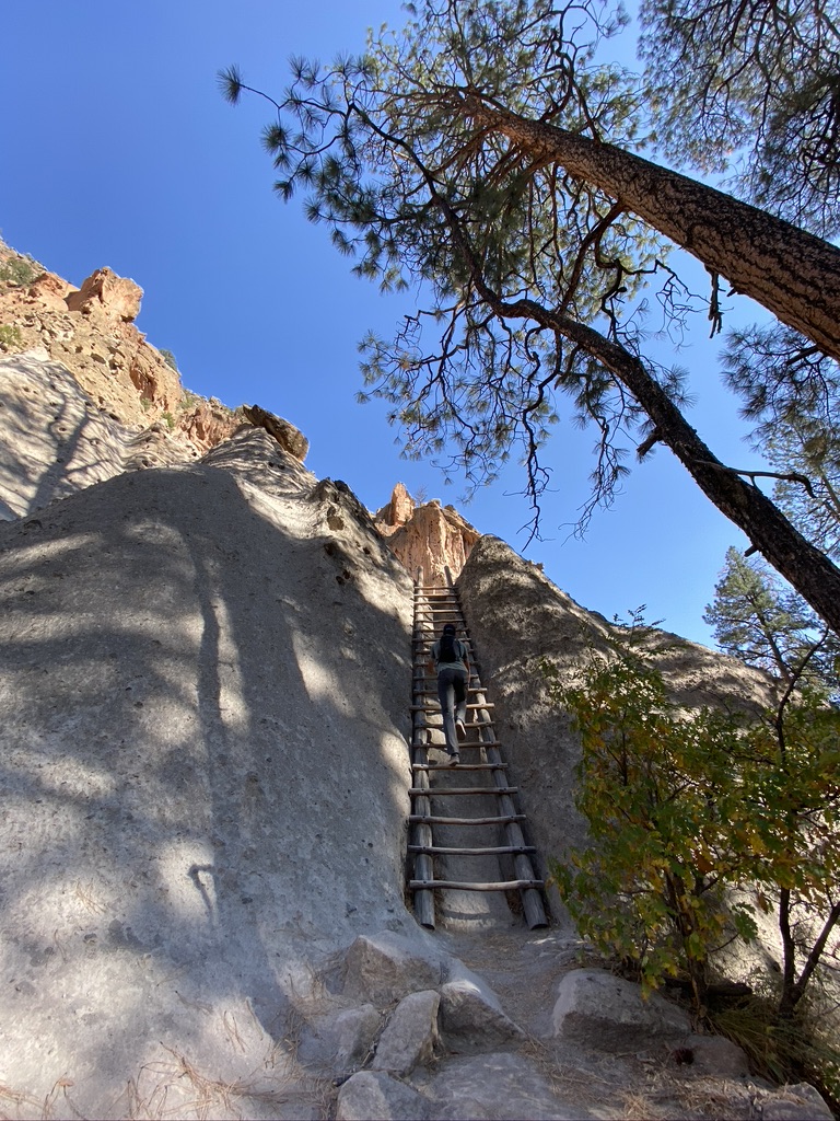
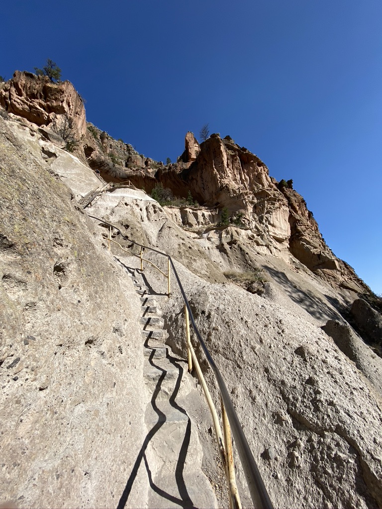
Alcove House
Alcove House was an additional mile or two off the main loop but worth seeing. It requires climbing a ladder and a series of pretty steep steps up a cliff to a cave where there’s an ancient kiva (religious/ceremonial place of the Ancestral Pueblo).
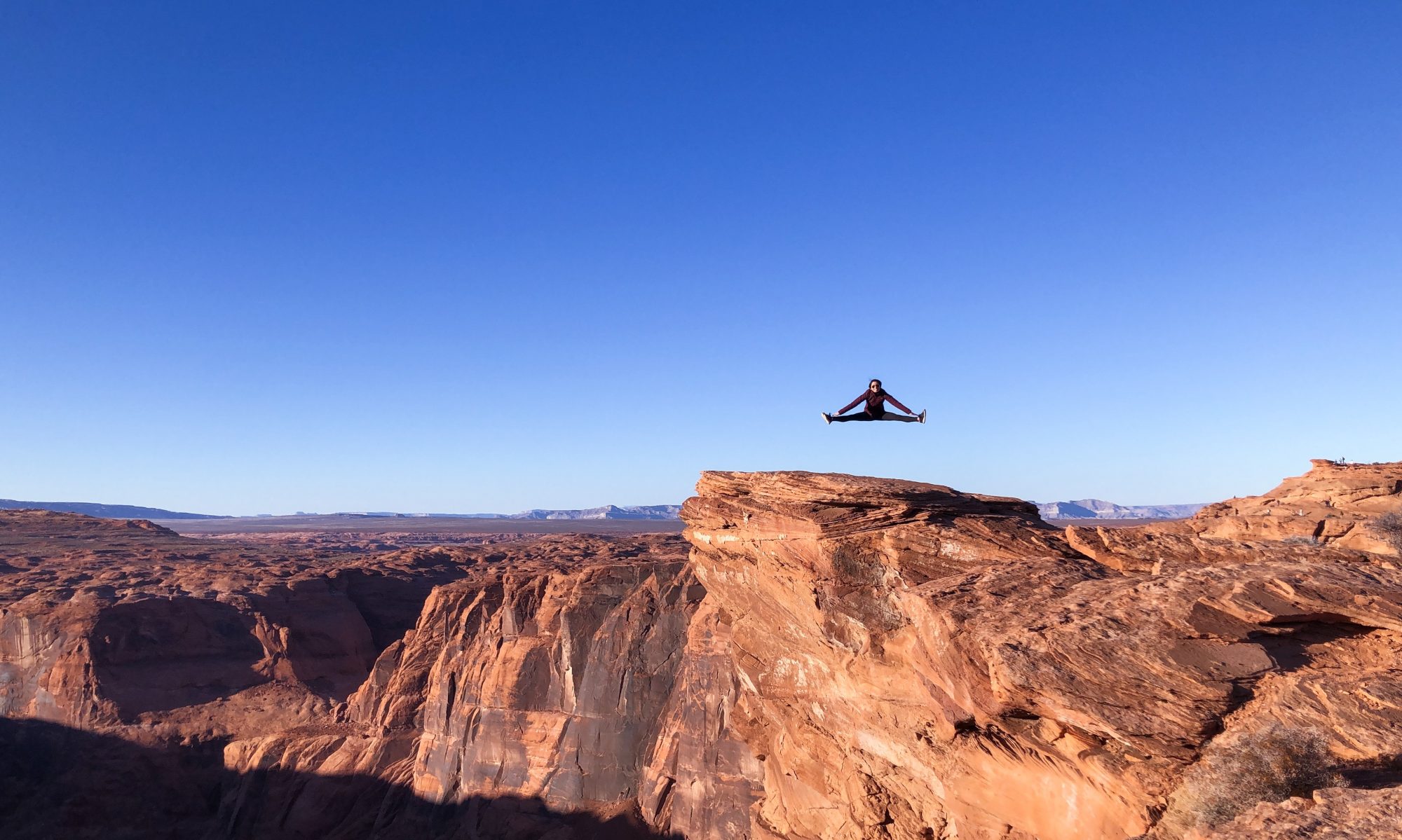
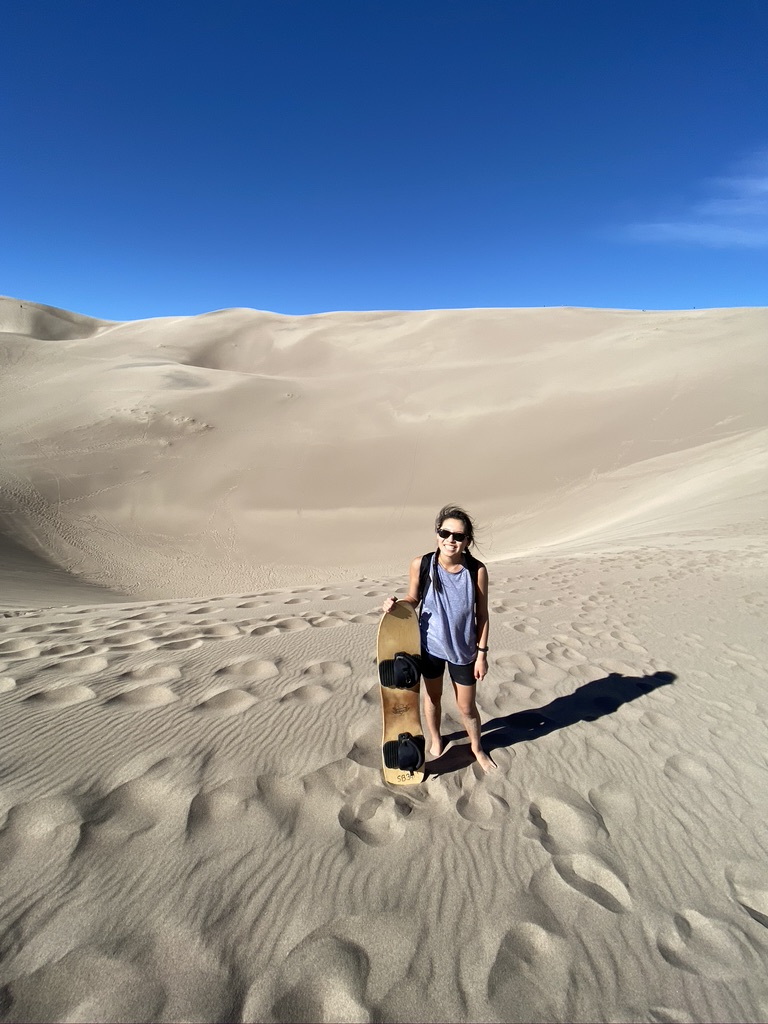
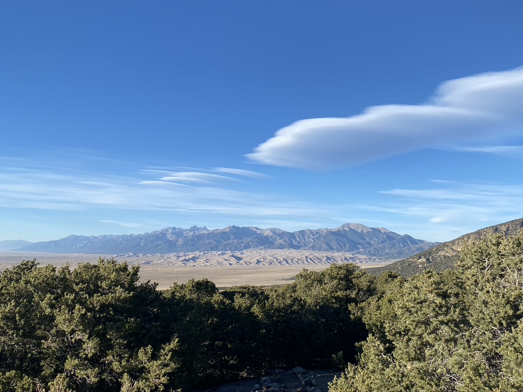
I had been to White Sands National Park before and figured the Great Sand Dunes were probably going to be similar, but despite having visited other sand dunes before, the Great Sand Dunes really blew me away because they were well…great (aka massive)!
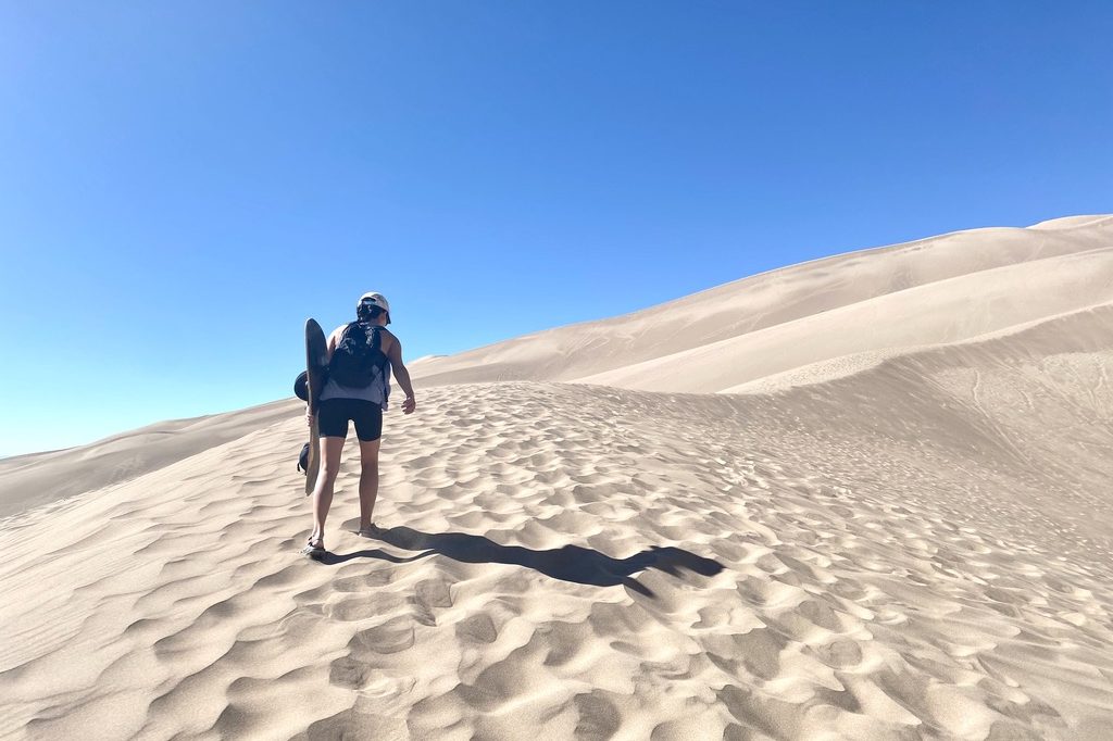
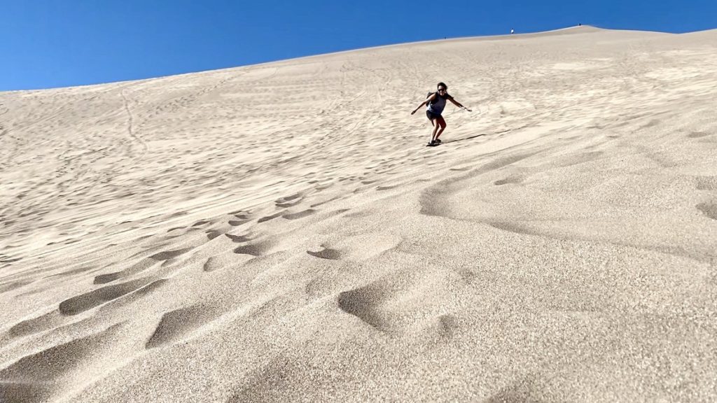
Sandboarding
There isn’t a ton of “hiking” to do in the Great Sand Dunes – we considered hiking to Star Dune (the tallest dune in North America) for maybe a second, but it would’ve been a hot, long, and not particularly rewarding hike (mostly a lot of walking with the same scenery).
Instead, we rented sandboards and went sandboarding which was an amazing time.
I love snowboarding so obviously was excited. We decided to just go in cold, straight for the tallest dune so hiked to the top of High Dune (which is the tallest dune you can see from the parking lot) and picked the steepest part to start. Obviously, I immediately fell and got sand all over myself, but it was really fun. I ended up washing sand out from my ears, clothes, everywhere for days.
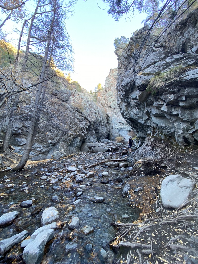
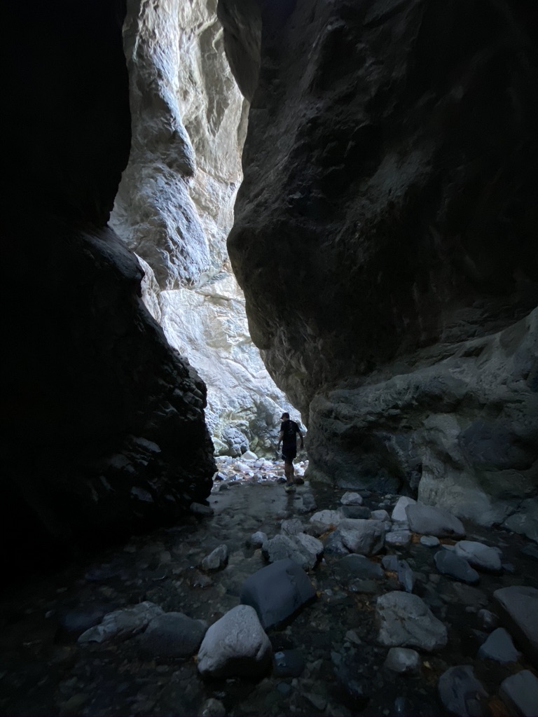
Zapata Falls
Like I mentioned before, there aren’t a ton of traditional “hikes” in the actual park, but right outside there is this short but really fun/unique hike to Zapata Falls. The hike requires walking through/across a small creek and through a short slot canyon to see the actual waterfall, but on a hot day it’s the perfect thing to do to cool off and get a change of scenery after a day in the dunes.
As an added bonus, we got this cool view of the sand dunes from afar.
Note: the drive up to the trailhead is along a bumpy, unpaved road which was pretty rough for our little sedan. It’s doable, but it was so bumpy we gave up and just left our car and walked the rest of the way up.
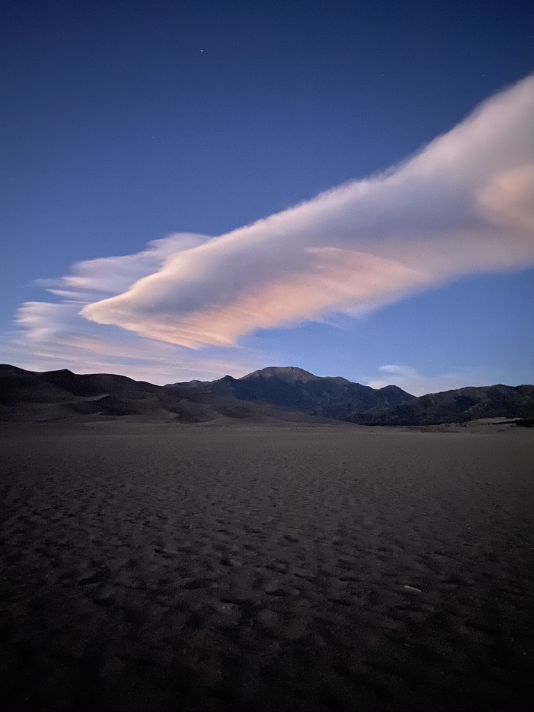
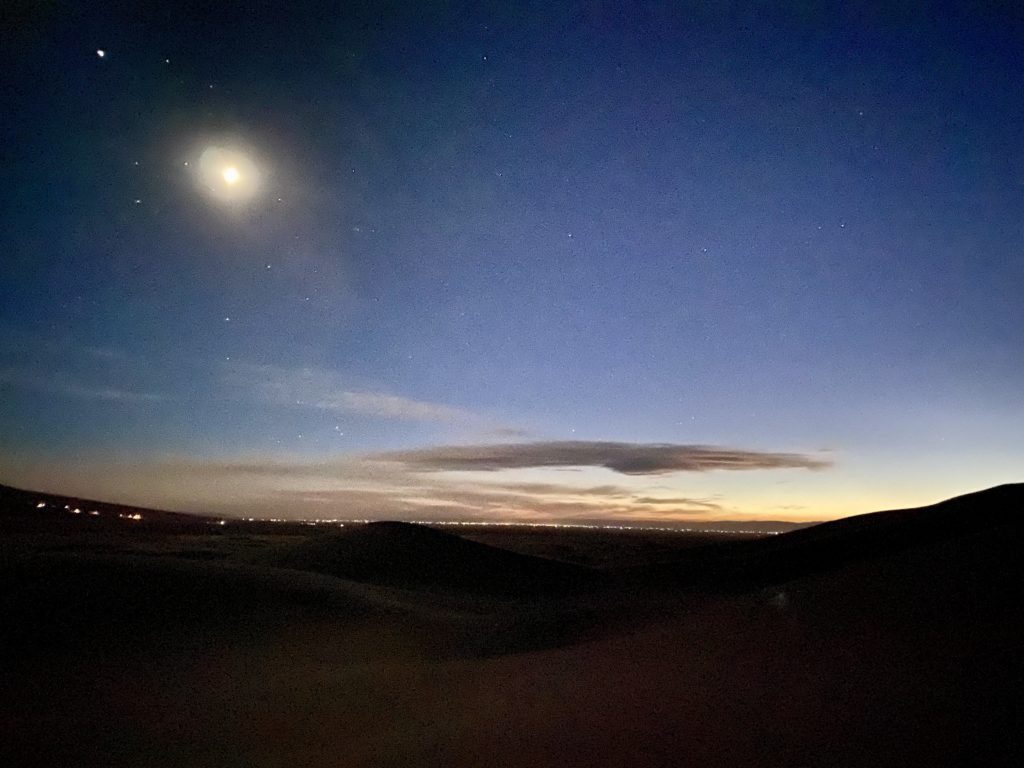
Night Hike & Stargazing
Great Sand Dunes is an International Dark Sky park so it’s one of the best places to go stargazing! The park is open 24 hours so after we finished the Zapata Falls hike, we came back into the park (with our headlamps in tow!) to do a night hike and see the stars.
Because it’s in the desert, it gets cold at night, so we bundled up! We didn’t have to go very far into the dunes to get darkness and a great view of the stars.
Here’s a picture of the sun setting on the sand dunes with the moon overhead, taken on my new iPhone which takes surprisingly decent night photos now:
Alamosa
We spent the night in Alamosa, a small town nearby, which had a lovely little Main Street with lots of great food options.
We had breakfast at Roast, a fun roastery/brewery – they had amazing biscuits and gravy and coffee!
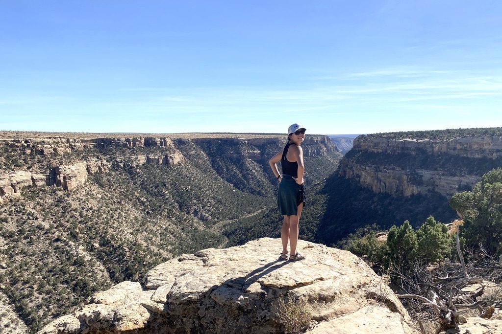
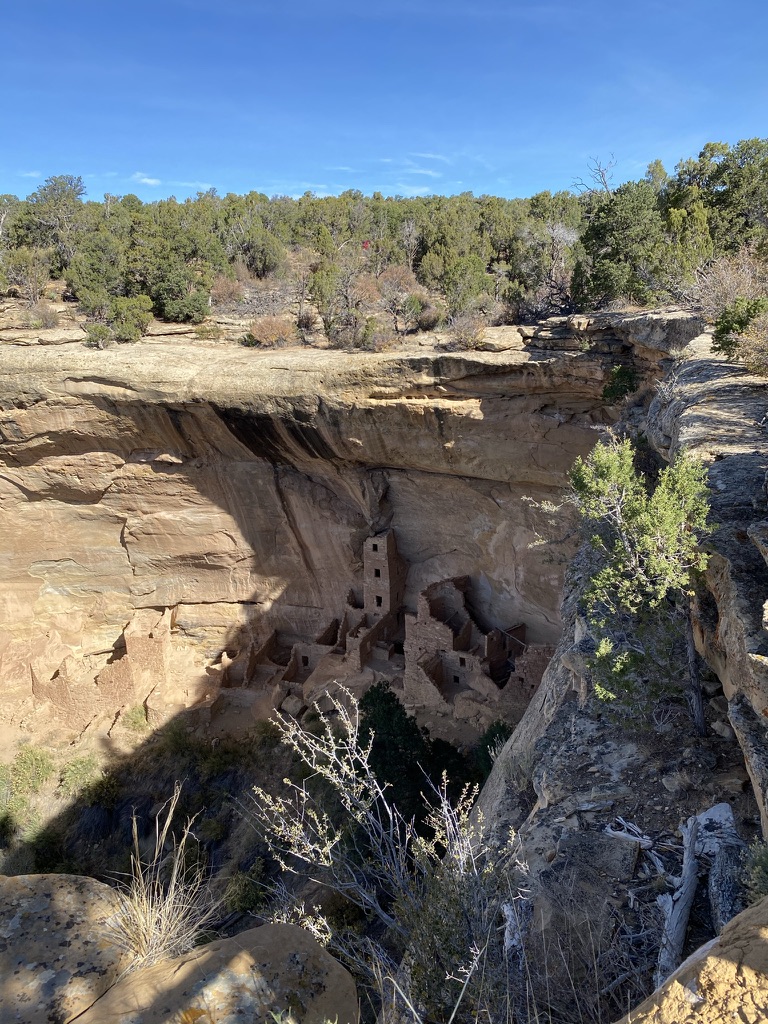
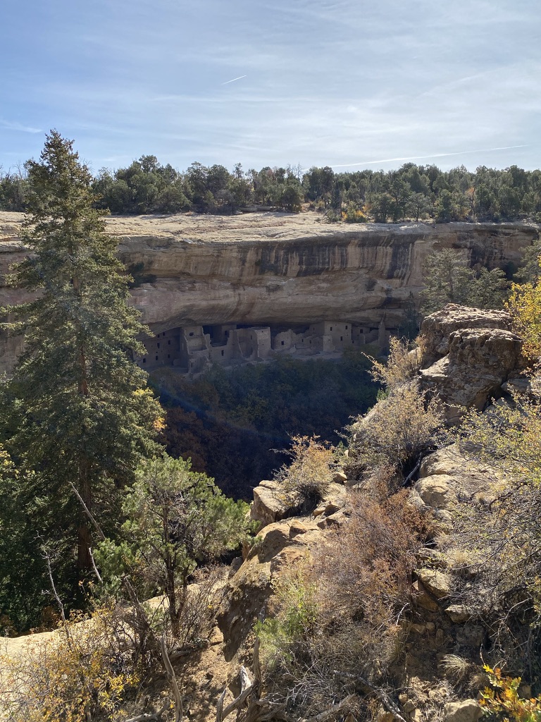
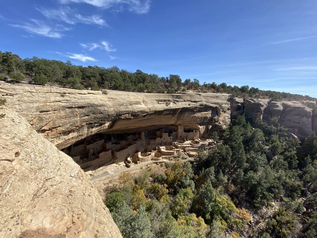
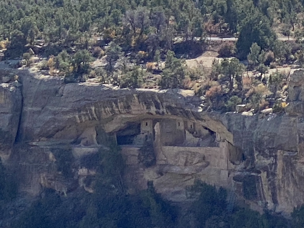
I hadn’t read too much about Mesa Verde beforehand so was kind of pleasantly surprised that it was as much a beautiful/nature-y park as it was a huge archaeological preserve. Mesa Verde is named for the canyons that make up the park that look like big green tabletops, but is perhaps more notable for the remnants of the amazing cliff dwellings built by the Ancestral Pueblo people who lived here as far back as 600 CE.
Most of the park involves driving out to various viewpoints and looking at the cliff dwellings. Here are some of the amazing ones we got to see:
Square Tower House
Spruce Tree House
Cliff Palace
Because of Covid, we weren’t able to take the ranger-led tours and actually climb into the dwellings which was sad, but we were able to see them from afar from various viewpoints and hikes.
Mesa Top Loop Drive
Because the official ranger tours we closed, we instead followed this self-guided audio tour as we drove along the Mesa Top Loop which gave us some great background info and also explained all the sites we stopped at along the drive. The park ranger who narrates the tour is a descendent of the Ancestral Pueblos so she sprinkles in lots of fun personal tidbits.
Note: there’s no cell service in the park, so make sure to download it before you go!
Soda Canyon & Balcony House
We mostly drove around the park to see the various viewpoints so didn’t really do much hiking, but we did do the very short Soda Canyon Trail to get out and stretch our legs and see Balcony House from afar.
Soda Canyon & Balcony House
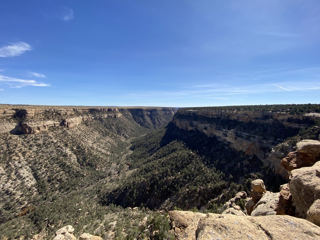
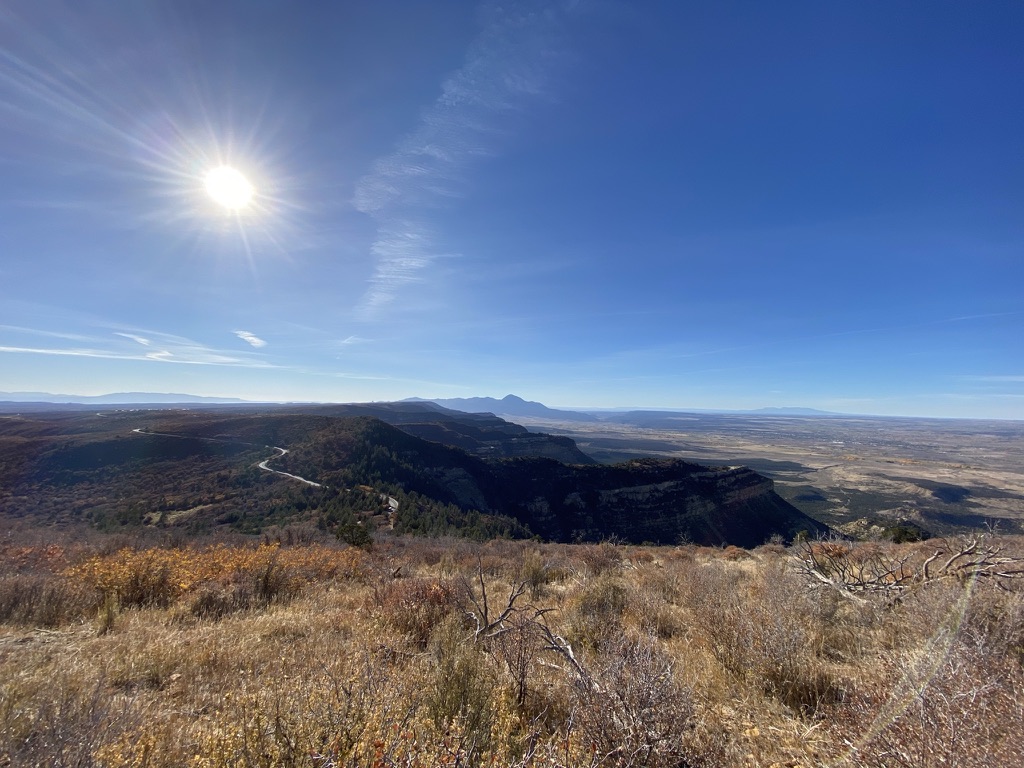
Park Point Overlook/Fire Lookout
On our way out of the park, we made a stop and walked out to Fire Lookout for a last view of the park from above as the sun was starting to set.
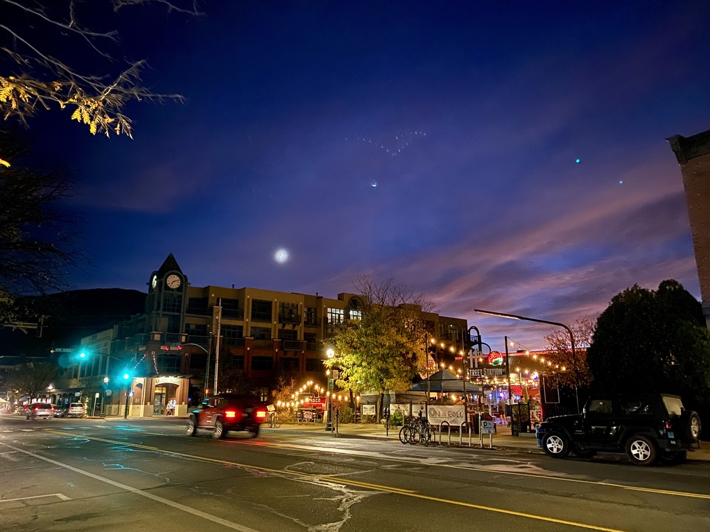
Durango
We stayed in nearby Durango for our two nights before and after going to Mesa Verde. Of all the towns in the Four Corners region we stayed in, Durango was definitely our favorite. It had the feel of a mountain/ski town (kind of reminded me of Bozeman or some of the Colorado ski towns like Breckenridge) and there were tons of fun breweries, cafes, and restaurants, and just a very cute Main Street/Downtown area.
I think if we had more time, we would’ve loved to have spent more time in Durango and done some hiking and other activities around here.
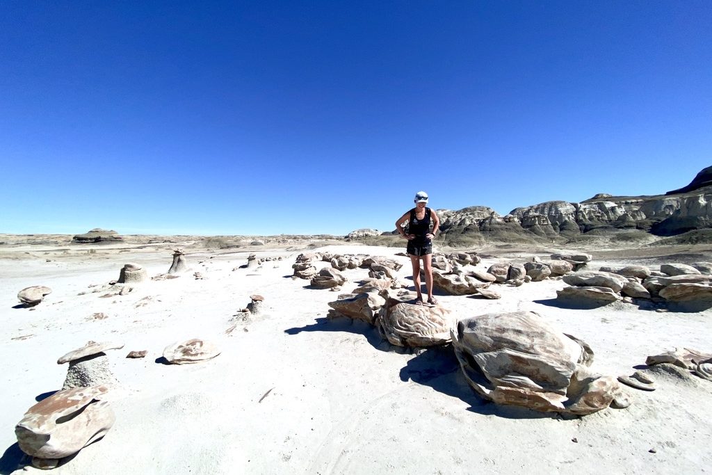
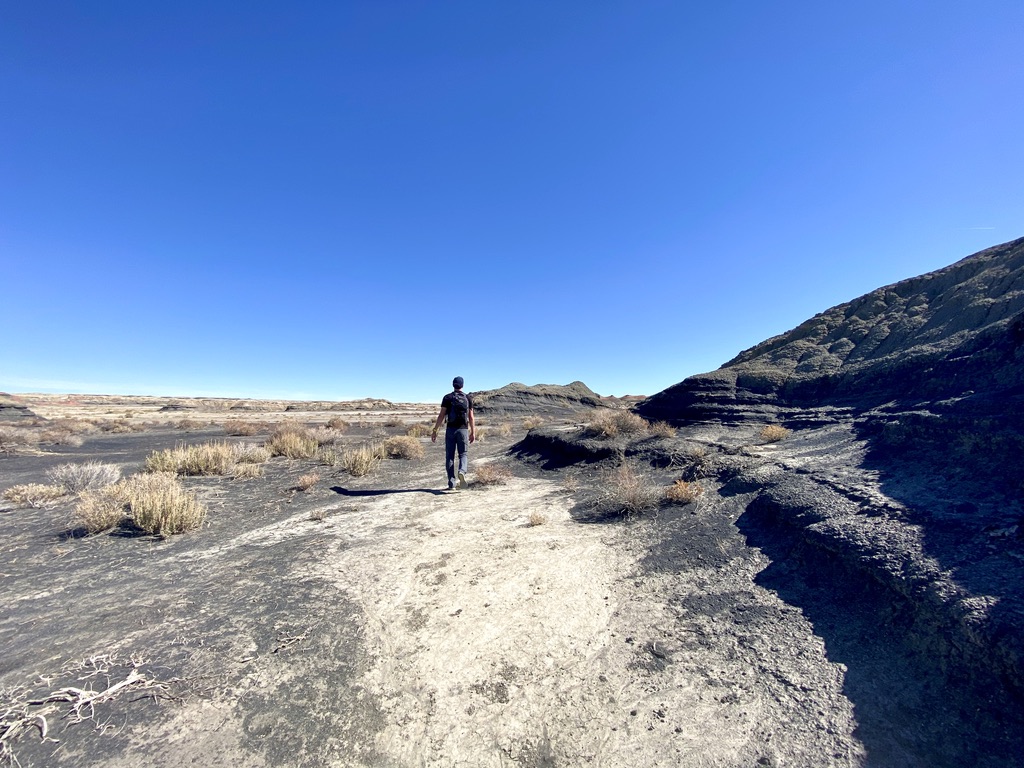
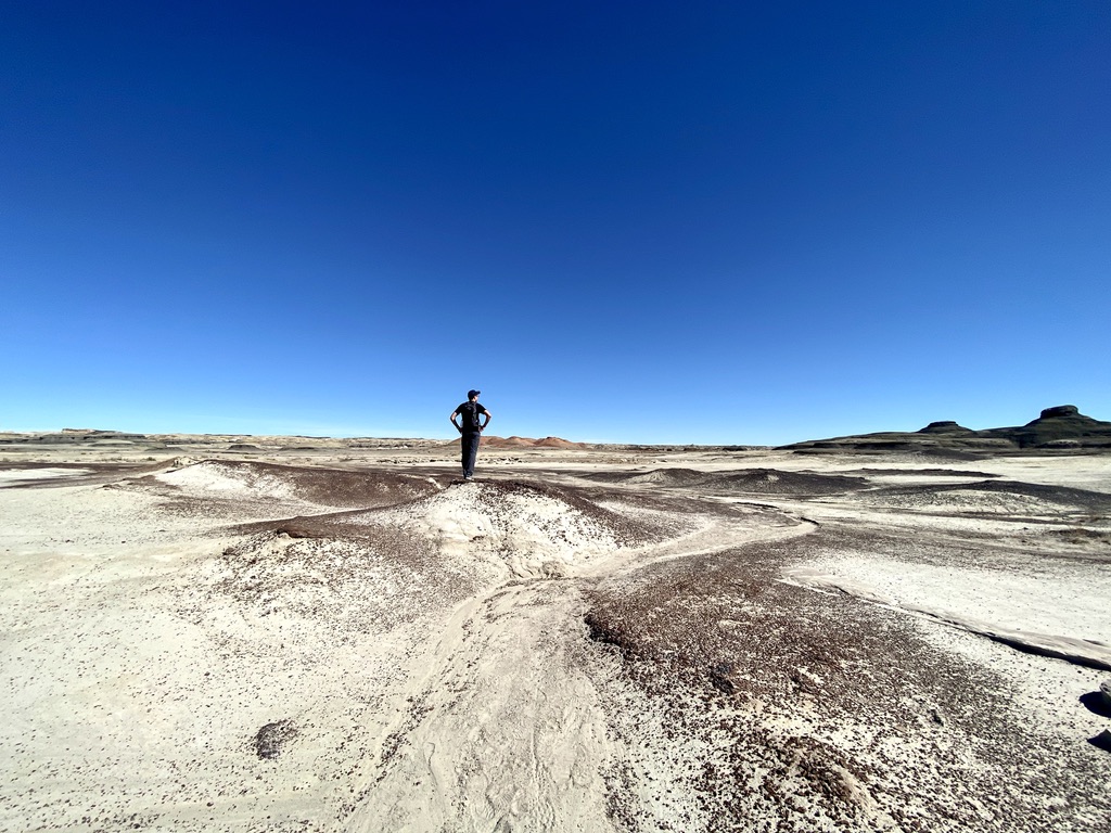
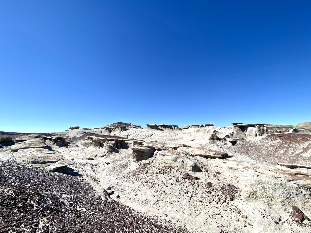
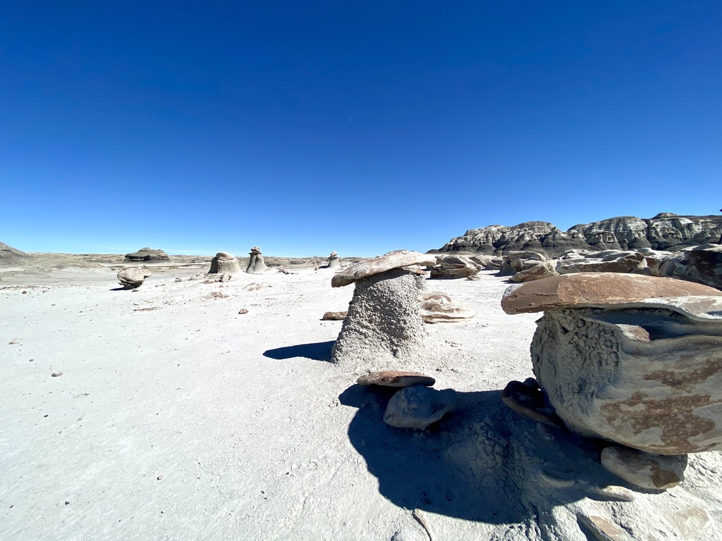
In an attempt to add a rest day from all the driving we’ve been doing, we tried to look for some things to do to break up our drive from Petrified Forest to Mesa Verde. We wanted to drive through Monument Valley or Canyon de Chelly, but sadly both of those (and almost everything else on Navajo Nation land) were closed due to Covid. Somewhat serendipitously, we ended up going to the Bisti Badlands, which I think we wouldn’t have otherwise discovered, but with all of its quirky rock formations and desolate landscapes, made us feel like we were transported into a Dali painting or another planet.
The main thing to know about Bisti Badlands is it’s kind of in the middle of no where. It’s on BLM land but has very very minimal infrastructure: there’s a very long and remote dirt road to get to it and once you’re there, there’s no water, no cell service, and only a pit toilet off of a small parking lot. So if you come, just make sure you’re prepared!
The hikes are also totally unmarked – we just followed a random map we found on the internet that had a series of coordinates to tell us where various landmarks were. There are a couple landmarks (which we’re not even totally sure we correctly found) including The Nursery, Cracked Eggs, and The Wings, but a hike through the Bisti Badlands mostly entails just walking around and looking at all the cool rock formations.
The Bisti Badlands used to be a pre-historic swamp that has through years of erosion and changes in climate formed this weird landscape of rocks, hoodoos, and arches. We spent almost two hours walking around the hoodoos and looking at the little rock formations.
Farmington, New Mexico
The closest town to the Bisti Badlands is Farmington which we also somewhat serendipitously drove through and stopped for lunch at a restaurant called The Chile Pod.
While we were waiting for our food and randomly Googling, we came across this NYT article about Farmington that was published just a few days prior (and also featured the restaurant that we were currently sitting in!) which profiled the small, rural town, formerly a bustling mining community now struggling to remake itself in other industries like tourism, but all of a sudden further devastated when Covid hit. With Covid and the looming election, it was a pretty sobering moment on our trip through the American southwest (where we played a game counting Trump vs. Biden signs along the road- Farmington also voted for Trump 2 to 1 in 2016) – indeed, here we were, a couple of coastal millennials who had seized the opportunity of remote work to travel the country in the midst of a pandemic; and here we were, coming to terms with it while reading a New York Times article in the middle of New Mexico.
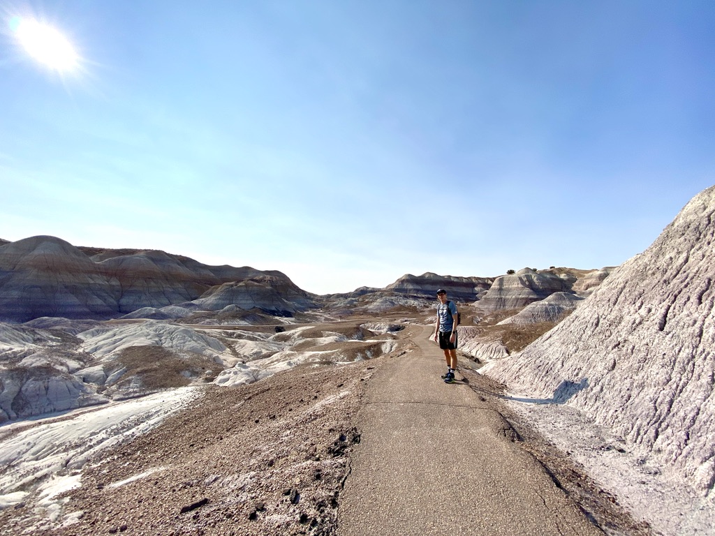
I didn’t know too much about Petrified Forest before going, and thought it was going to be kind of boring and just a bunch of petrified wood, but it turned out to be a really amazing place! Petrified Forest is not a huge park – we drove here after visiting the Grand Canyon (~3 hour drive away) and had about half a day but felt like we had plenty of time to see everything.
The park has two main sections:
The logs – southern part of the park where there are tons of petrified logs
The Painted Desert – the northern part with mesas and a colorful desert
One main road goes through the park and we drove from south to north, seeing the logs first and then ending up in the painted desert area for sunset.
Giant Logs, Long Logs, Crystal Forest
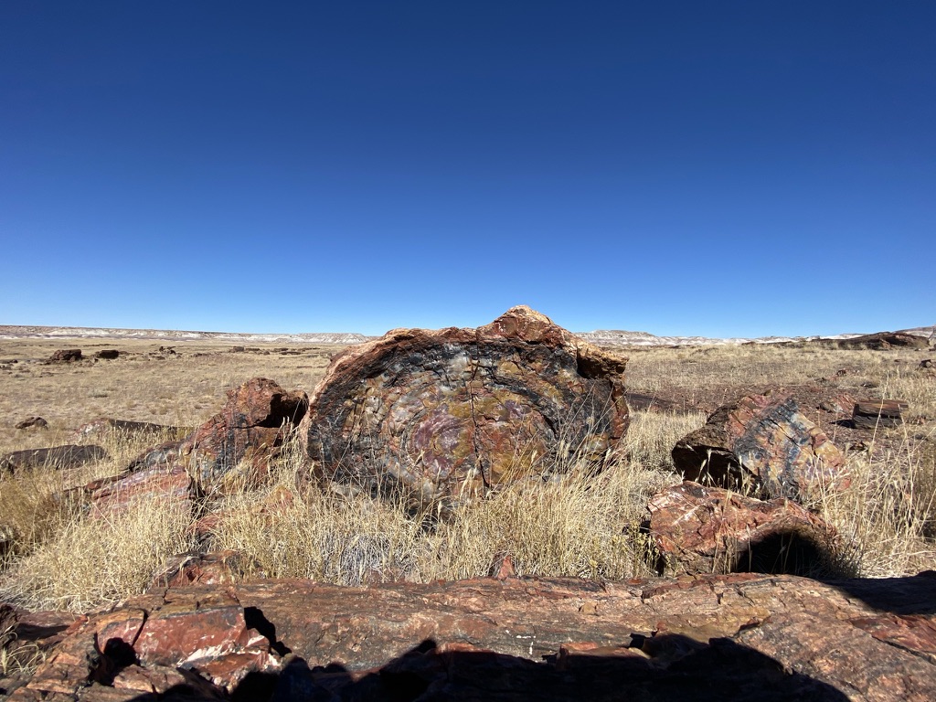
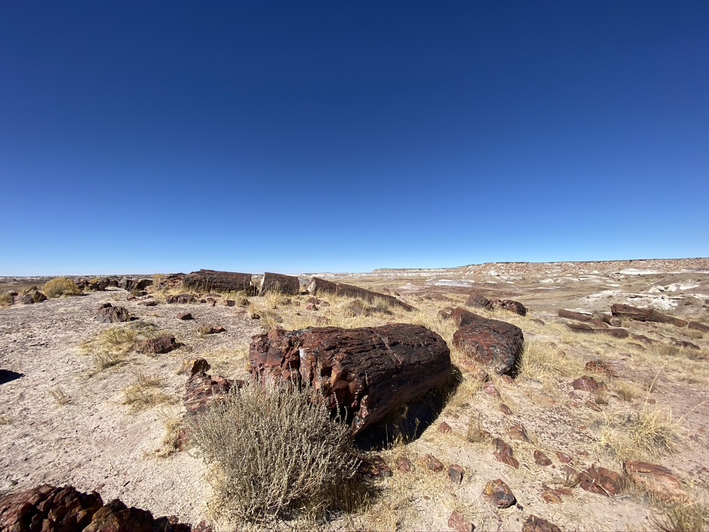
Petrified logs are formed when trees fall and minerals and mineral-infused water get absorbed into the wood and crystallizes. They’re really amazing because they look just like regular logs but when you touch them, they’re totally solid pieces of rock.
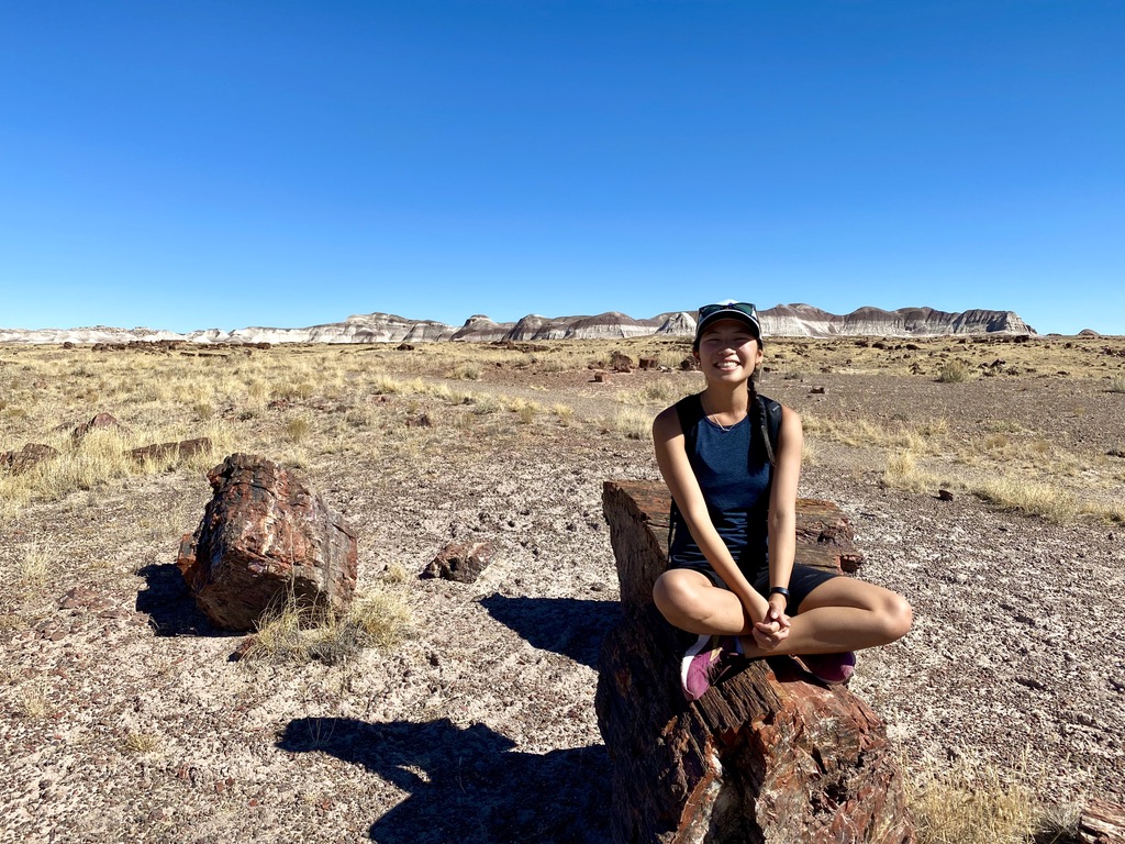
There’s a series of short hikes (1-2 miles or less) near the southern entrance/visitor’s center that showcase the petrified logs, which are just strewn about everywhere along the trails. We did the Giant Logs, Long Logs, and Crystal Forest trails and it was fun to see and touch the logs up close.
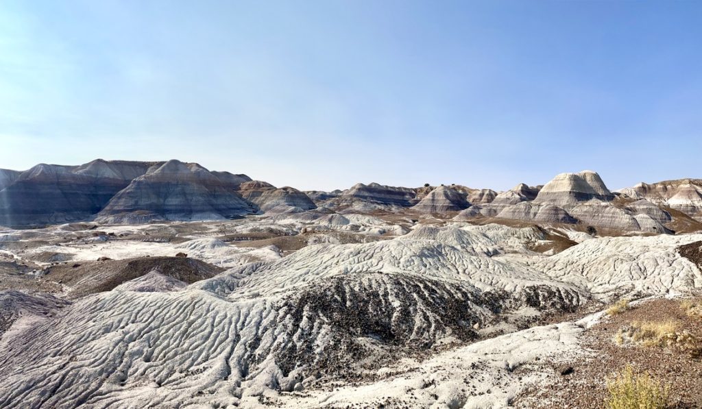
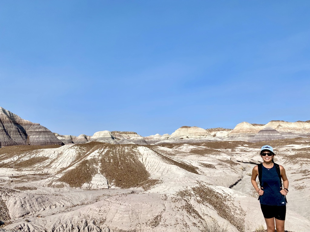
Blue Mesa Trail
The Blue Mesa trail might’ve been my favorite part of Petrified Forest. It’s short, but a really fun walk through badlands of bluish clay.
We didn’t have time, but Petrified Forest also has some “Off the Beaten Path” trails that are unpaved and unmarked and if we had more time, I would’ve loved to have done the Blue Forest Trail which goes through this area but is longer and gets more up close with the mesas.
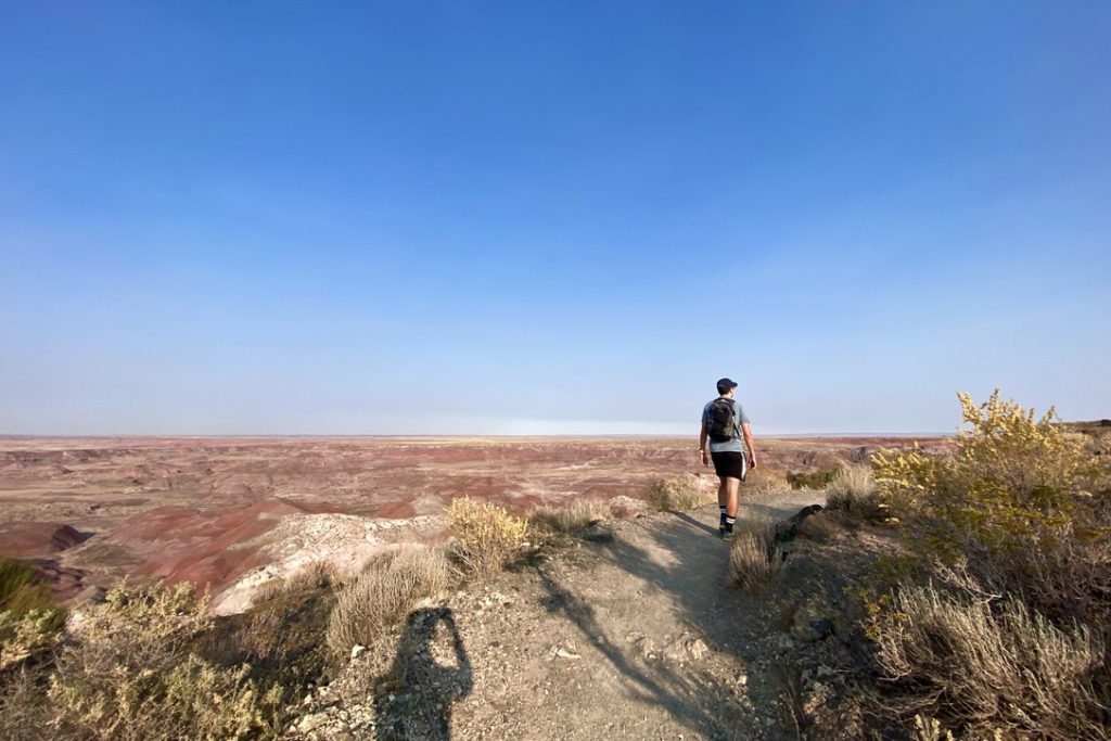
Painted Desert Rim Trail
We ended our day with a sunset hike along the rim of the Painted Desert, which was already beautiful with all its pink and white layers but was even more spectacular with the sunset glow.
Gallup, New Mexico
We were headed towards Mesa Verde next, so from here we drove about an hour to Gallup and spent the night there (which was the next remotely large-ish town in the area).
We had dinner at Smokey’s BBQ which was actually great barbecue and also very reasonably priced!
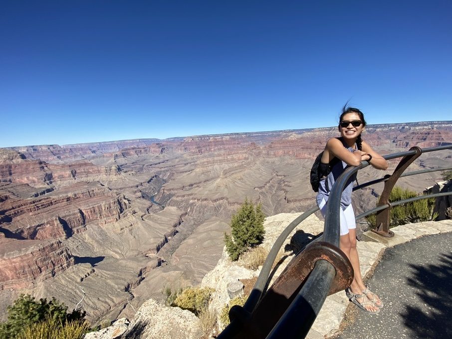
I don’t think the Grand Canyon needs much intro – it’s one of the most well-known and iconic national parks in the US, with millions of visitors each year.
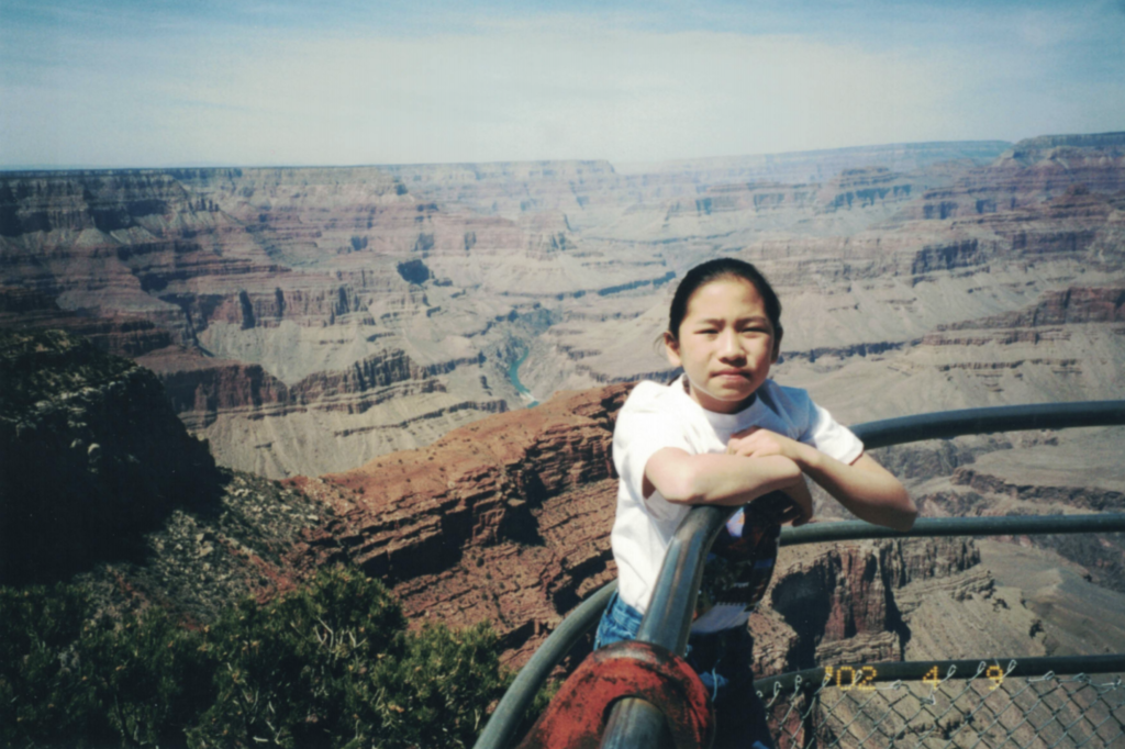
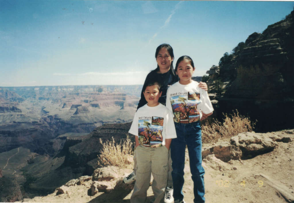
The first time I went was in 2002 with my family when I was just 10 years old. I honestly don’t remember too much, but since it was a whole family trip, with kids and grandparents, we didn’t really do any hiking – we mostly drove and got out and looked at the viewpoints. But I think that’s what makes the Grand Canyon so appealing to so many people: there’s something for everyone. For families and less mobile people, it’s very drive-able (or you can even take a helicopter or mule ride). For people who want a more active experience, there are bike trails and hikes. And for the adventure-seekers, there are rapids on the Colorado River and multi-day hikes and camping in the backcountry. The one constant: the views are amazing.
At the Grand Canyon in 2002 and 2020
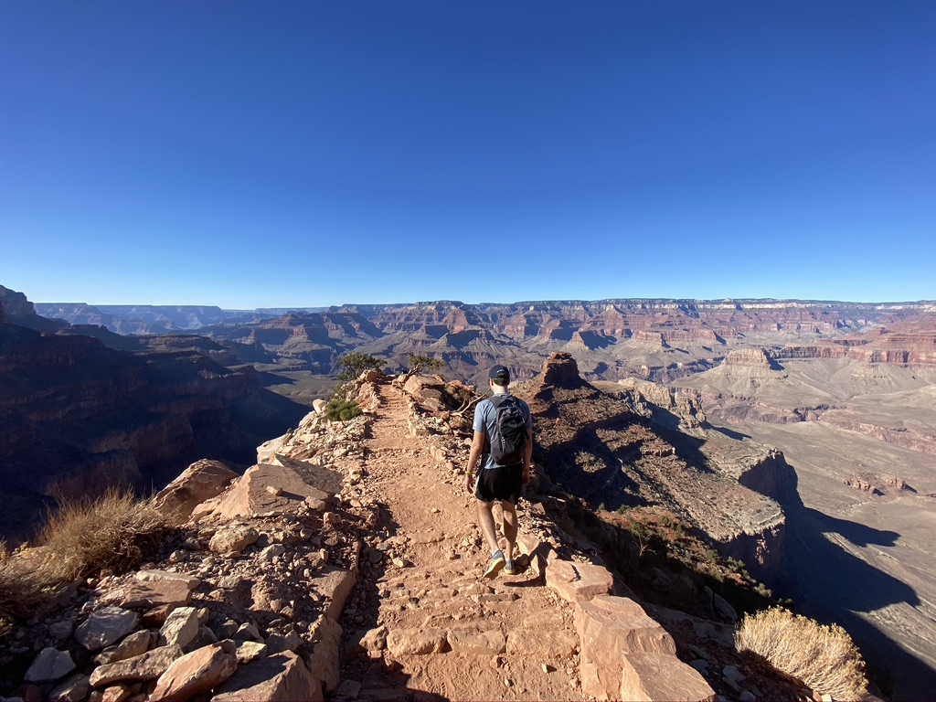
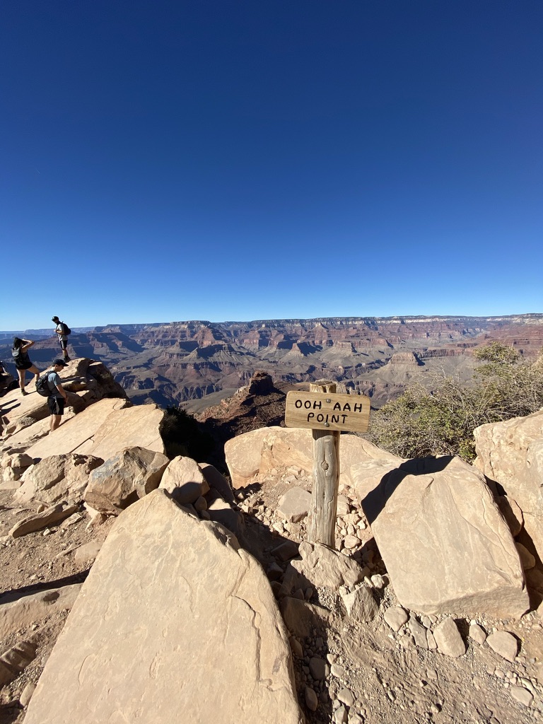
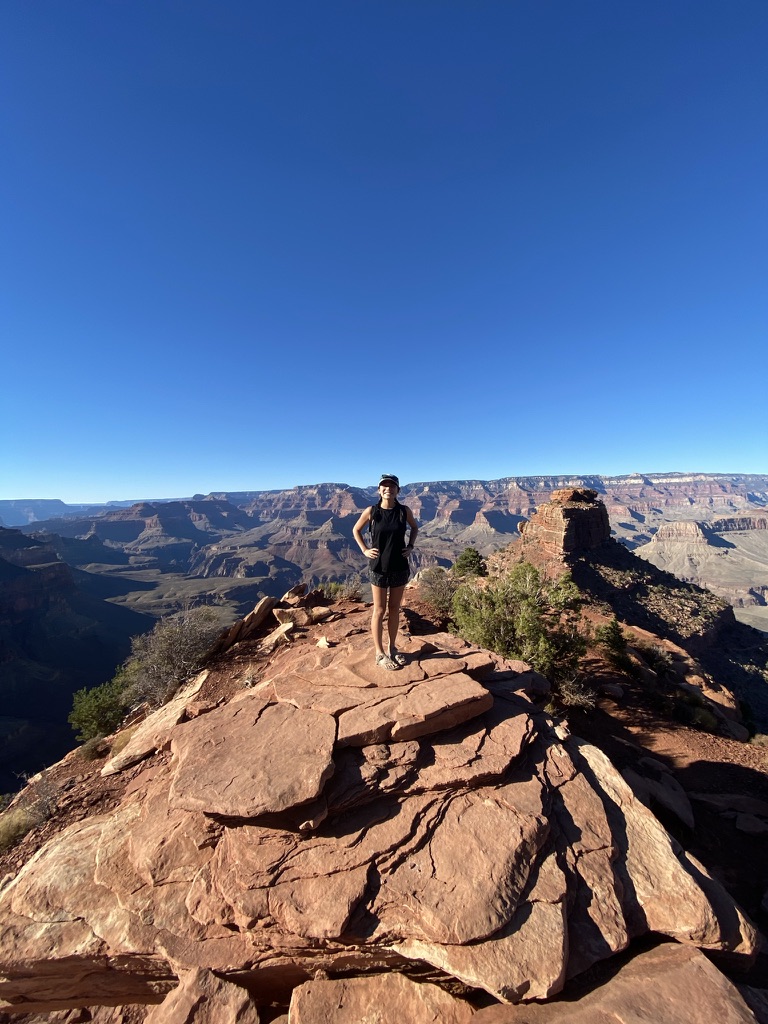
South Kaibab Trail
The South Kaibab Trail is super underrated, and I think if someone only had time to do one trail in the Grand Canyon, this is definitely the one I would recommend. Because it’s a bit further and only accessible by shuttle, it’s not as crowded as the Bright Angel Trail (its more popular counterpart). The views on South Kaibab are also way better because you get more expansive views of the canyon.
It’s an out and back trail, so you can hike as much of it as you want and turn back. Most people hike out to Ooh Aah Point (~2 miles roundtrip), but we went a little further to Cedar Ridge (~3.5 miles roundtrip), and of course if you had more time you could keep going down to Skeleton Point or all the way down to the Colorado River by backpacking overnight.
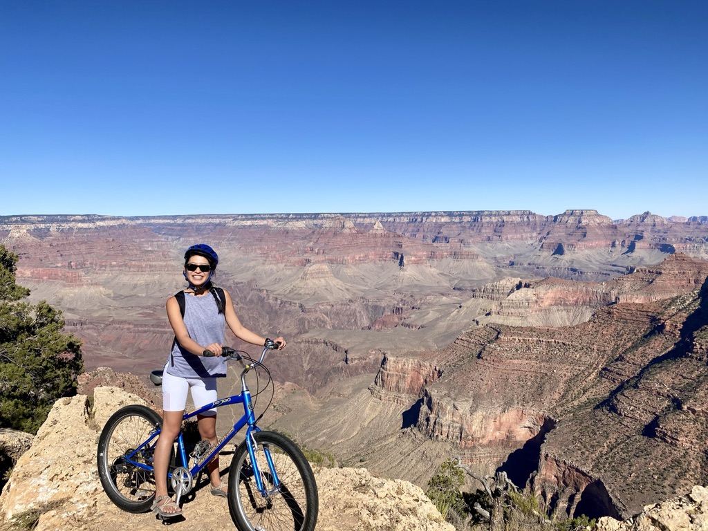
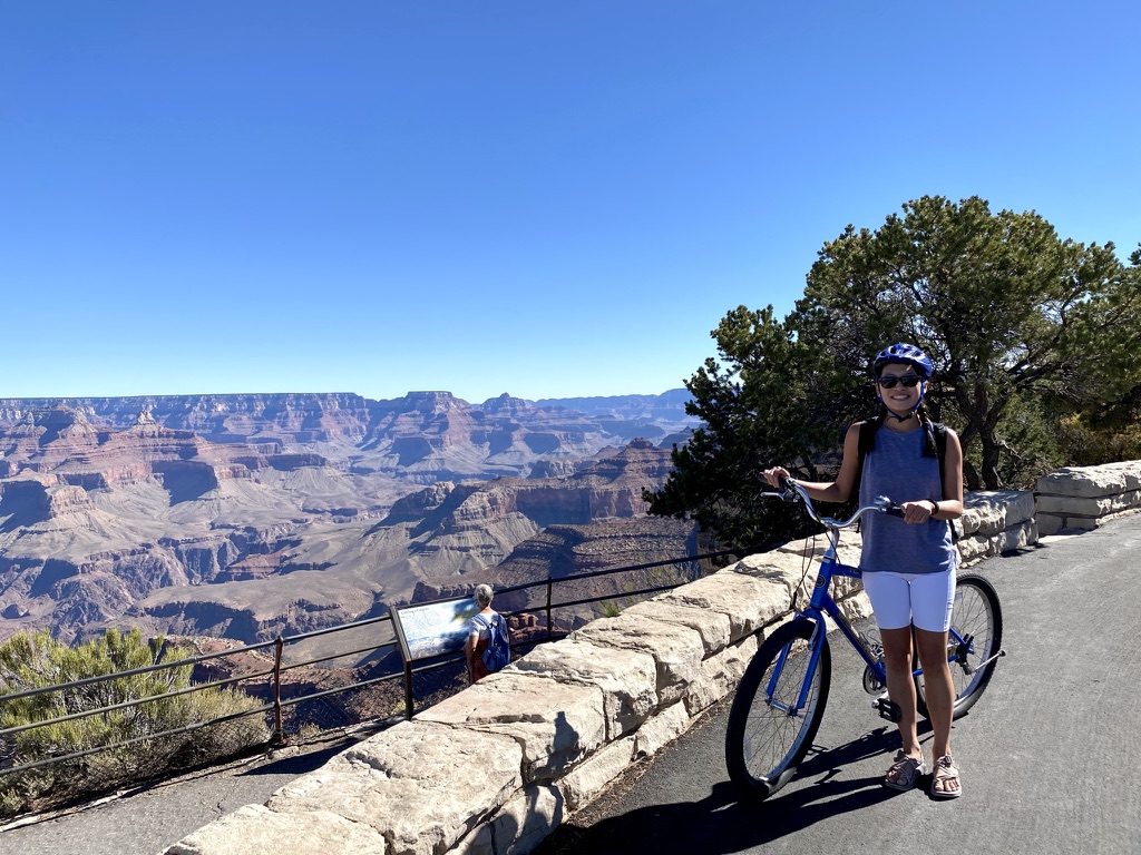
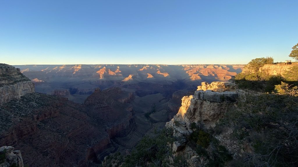
Biking Hermit’s Road
Biking has been one of my favorite ways to see the National Parks (we also recently biked in Zion), so for our second day in the Grand Canyon, we rented bikes and did the ~20 mile round trip ride from the Visitor’s Center up Hermit’s Road to Hermit’s Rest and back, stopping at all the viewpoints along the way.
Like Zion, the shuttles in Grand Canyon are very bike-friendly, so you can hop on and off with your bike if you don’t want to bike the whole thing, but we had a great time doing the full shebang. We also saw plenty of people throughout the day hopping on and off the shuttle at the various viewpoints and taking short walks out to see everything.
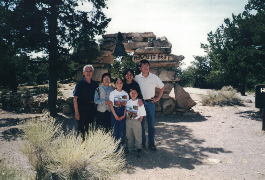
Top: with Mom, Dad, and Willy in Apr 2002 Bottom: Hopi Point with my bike in Oct 2020
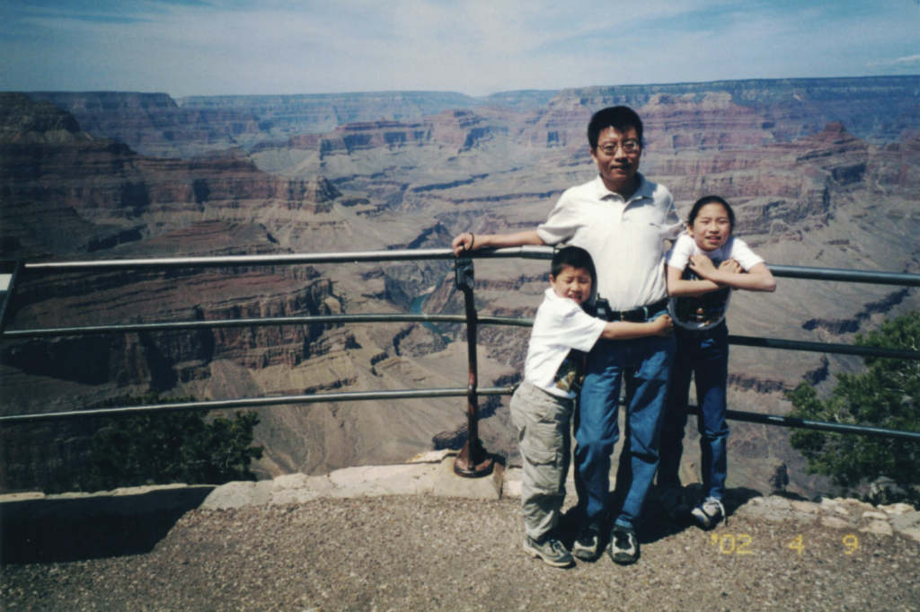
You can turn back at any point, but Hermit Road ends at Hermit’s Rest which is an old rest house from back when travelers would arrive by coach and stop for a cool drink before heading down to the old Hermit Camp.
With the fam at Hermit’s Rest in 2002
Bike rentals: the main bike rental company in the park is Bright Angel Bicycles. They’re very friendly and also run tours and their own shuttles and made things very straightforward and easy.
Bright Angel Lodge + El Tovar Hotel
I very rarely take advantage of the opportunity to stay at the lodges inside parks that are run by the park service, but for this trip, we stayed at the Bright Angel Lodge in Grand Canyon Village and it was an amazing experience.
Sunset from outside our lodge
The lodges are built right on the rim of the Grand Canyon and every morning we would wake up, walk out of our lodge, and be able to eat breakfast as the sun was rising on the rim of the canyon. At night, we could go stargazing right outside our room sitting on a ledge.
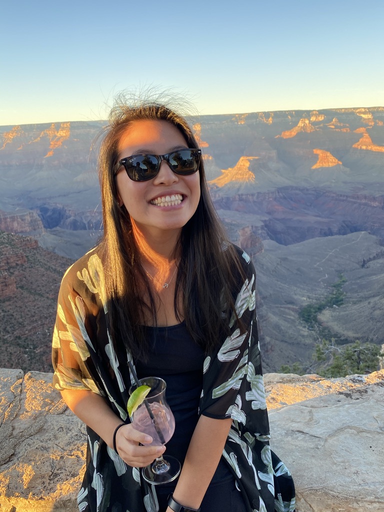
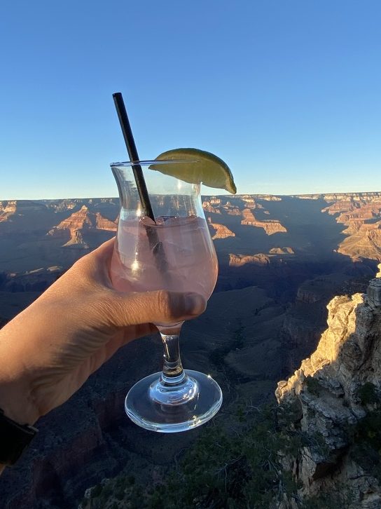
Sipping my prickly pear margarita while watching the sun set on the Grand Canyon
The El Tovar Hotel next to the lodge also has a restaurant and bar that overlooks the rim of the canyon. We had dinner and drinks here both nights (reservations fill up quickly, and the food is only decent, but definitely worth the experience).
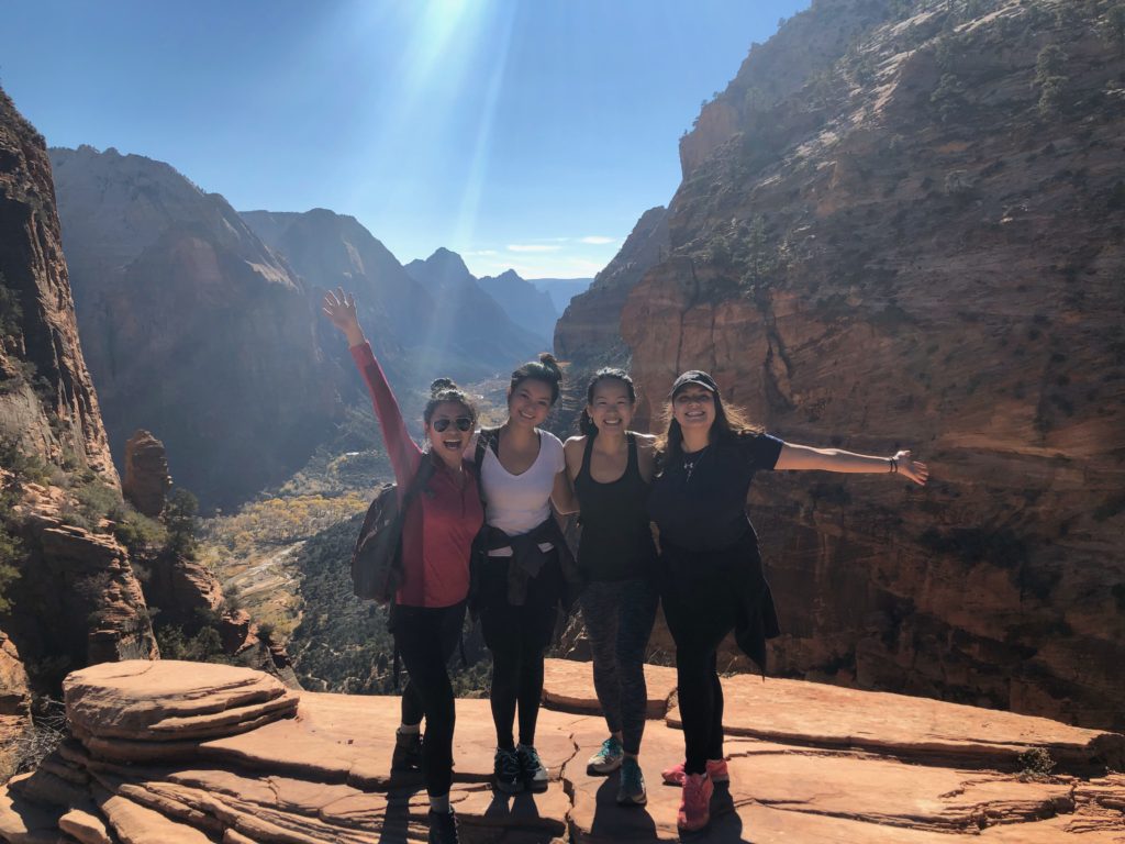
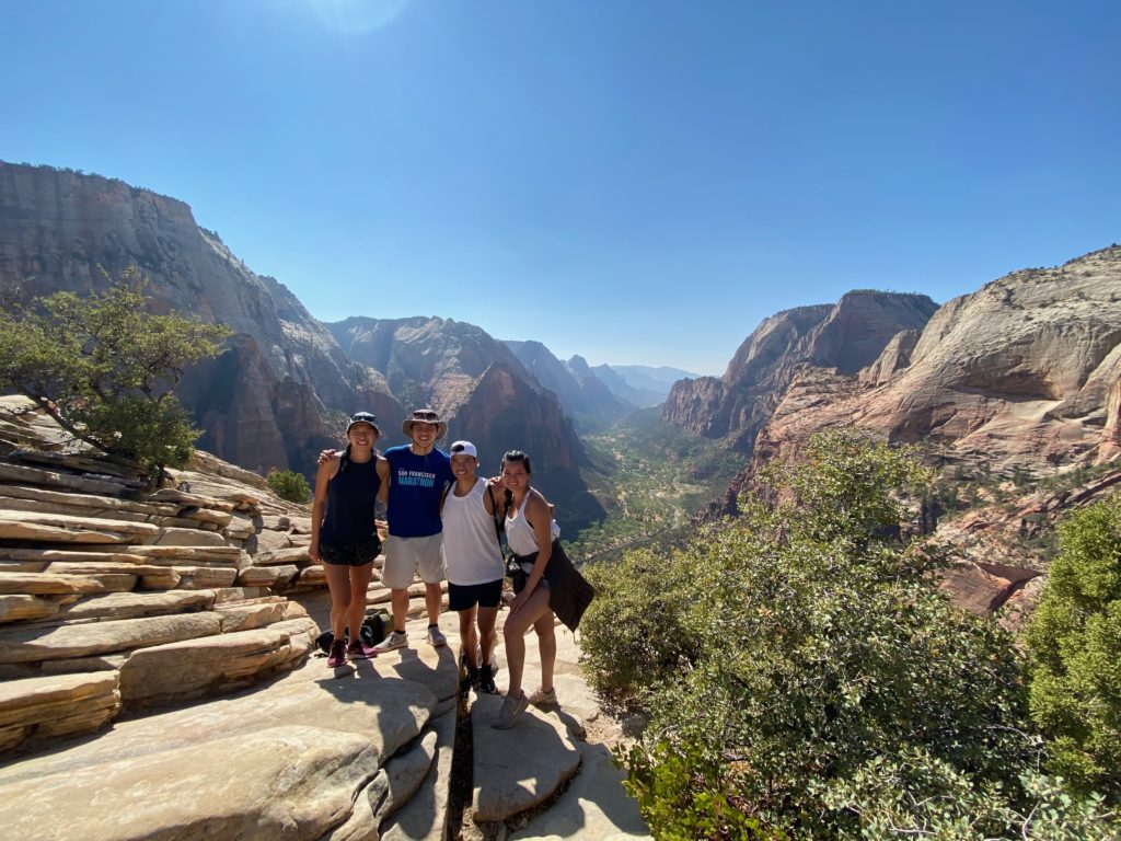
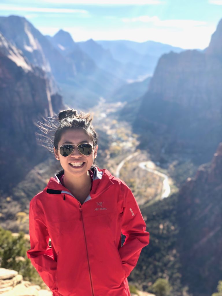
I went to Zion over Thanksgiving break with Anna, Amy, and Margarita two years ago and we had an amazing time, so I was excited to go back again this time with Willy. In a funny turn of events, Anna ended up flying down from SF and joining us in addition to roommate Willy who was already here from LA. All of us had already been to Zion except brother Willy, but we had an amazing time even for our second time.
Almost same crew, two years apart, better iPhone camera quality Left: Karen, Anna, Amy, Margarita in Nov 2018 Right: Karen, Brother Willy, Roommate Willy, and Anna in Oct 2020
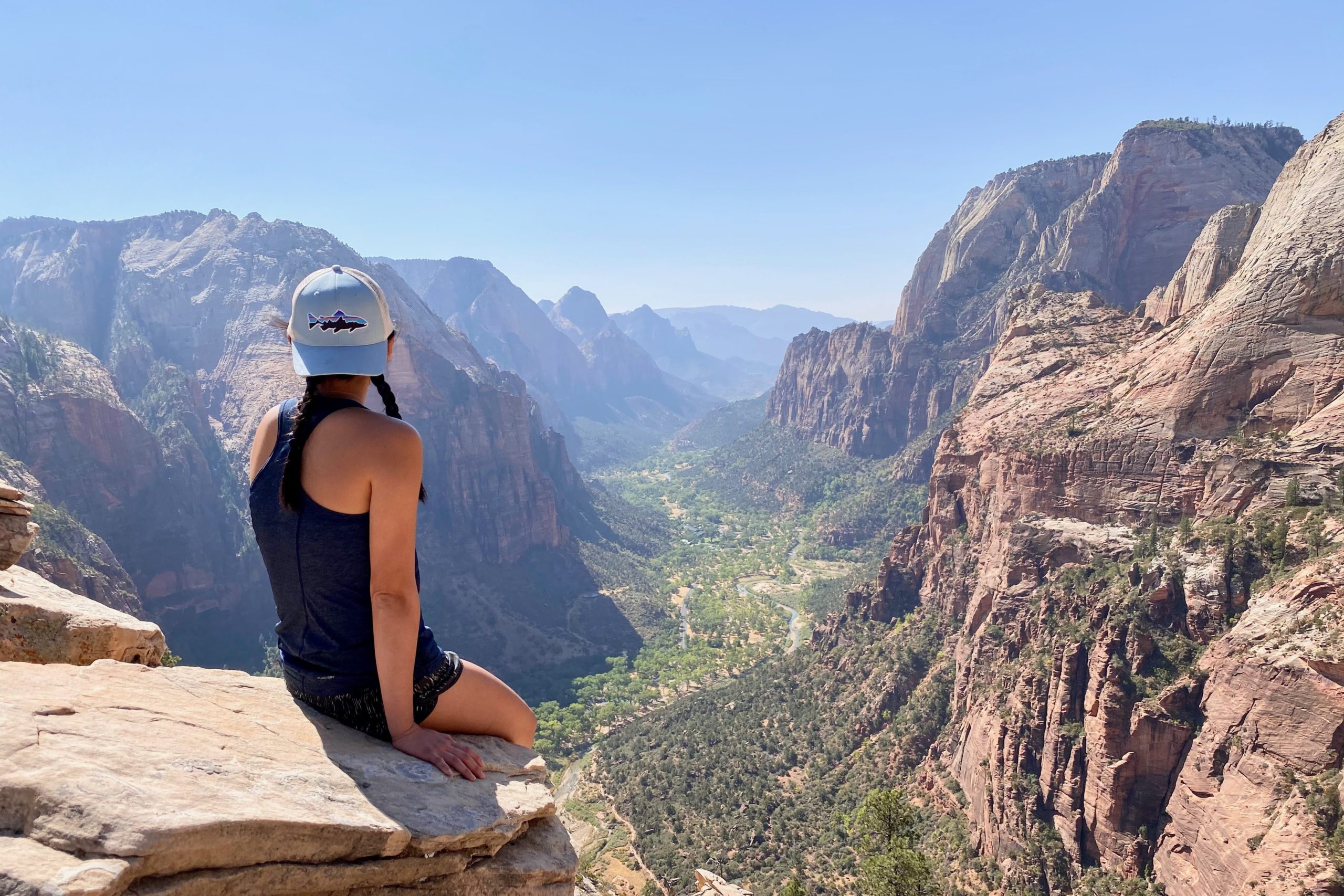
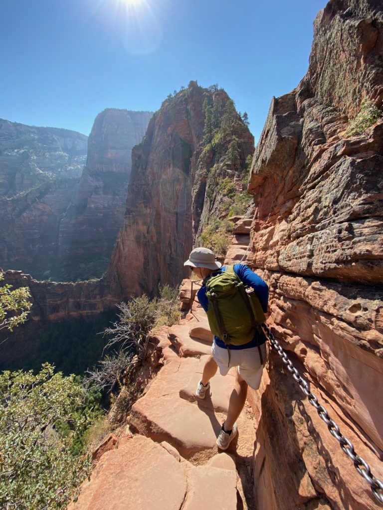
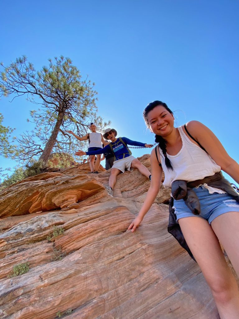
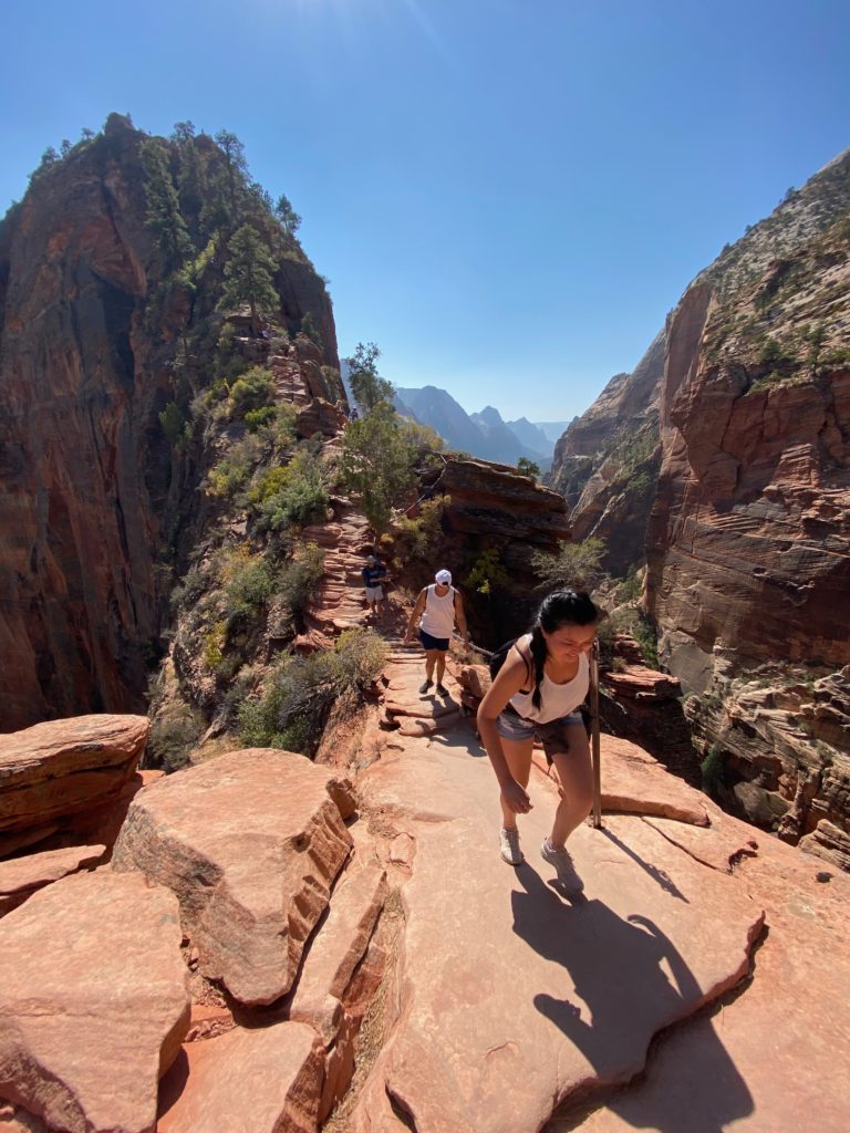
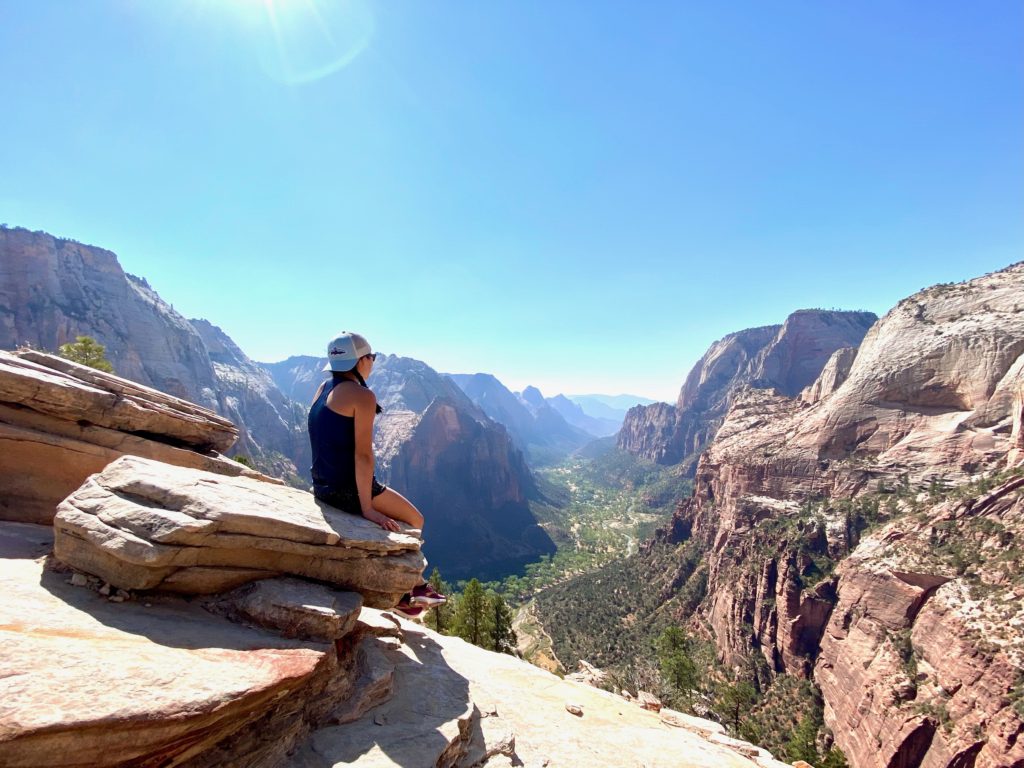
Angel’s Landing
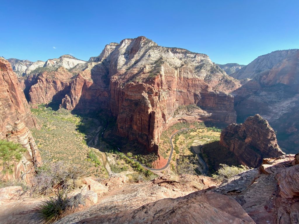
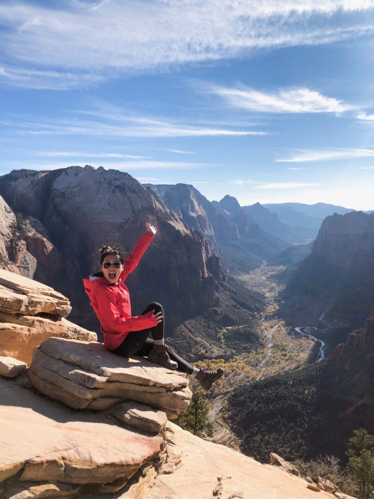
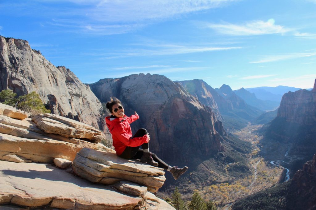
Angel’s Landing is one of the two signature hikes in Zion, and it’s really no joke. The entire first half is a series of pretty steep switchbacks, followed by a mentally terrifying section up a narrow path where you have to hold on to a chain all the way to the top. Willy was on his butt for many parts of the second half because it was just so scary to stand up.
The view from the top sure is worth it though! Here are some pics of me at the top of Angel’s Landing from my trip in 2018:
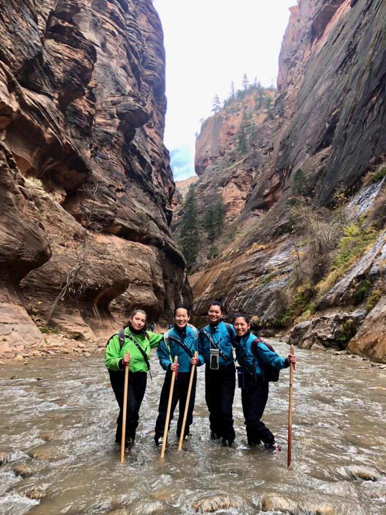
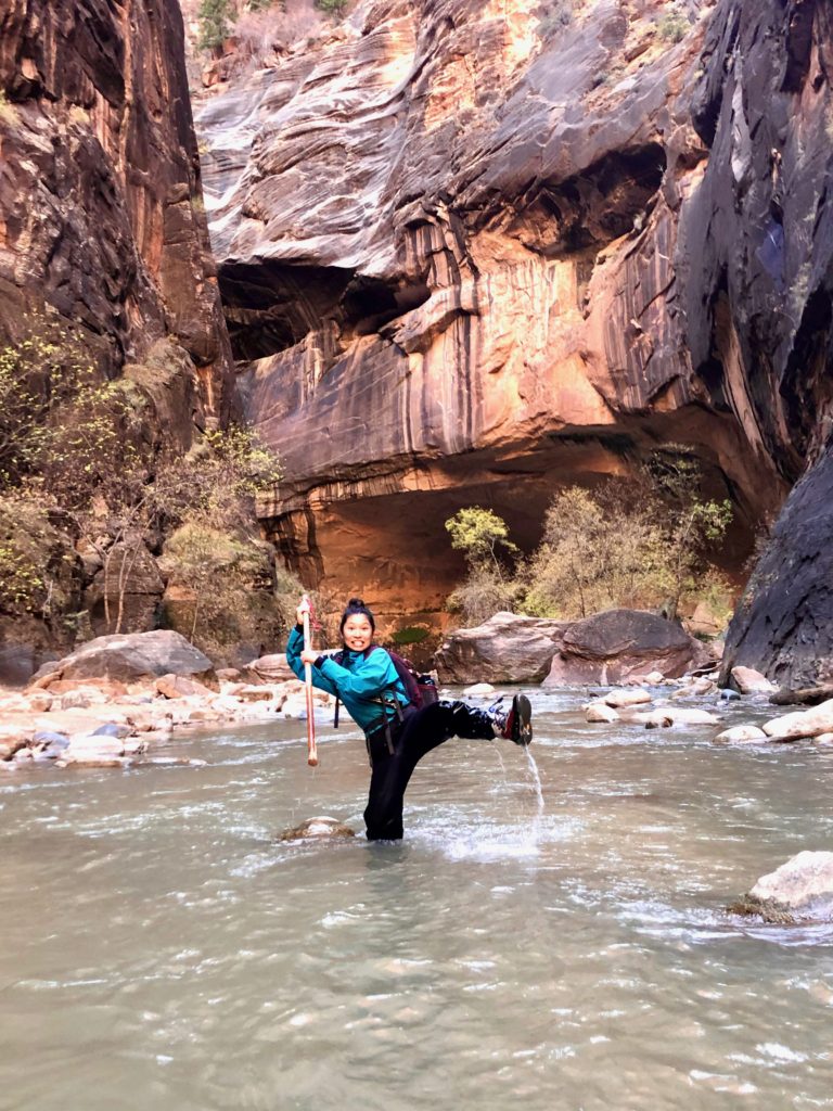
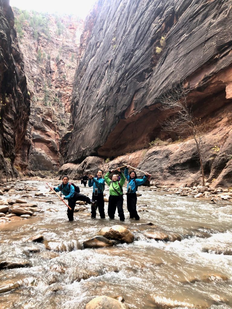
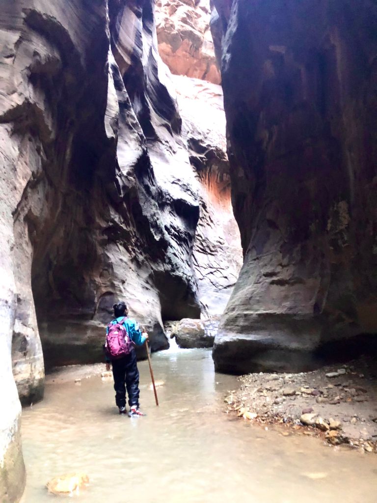
The Narrows
The Narrows is probably the most unique hike I’ve ever done. The hike essentially takes you along the Virgin River through the narrowest part of the Zion Canyon, at times submerged chest-deep in water.
We didn’t get a chance to do The Narrows hike this time because we were short on time and there was also a toxic cyanobacteria infestation in the Virgin River (though plenty of others were doing it regardless of the toxic bacteria). However, if you’re here during the right time of year (when there aren’t flash floods) and not during an infestation, this is definitely my favorite experience in Zion.
In 2018, we went in November, so the water was pretty cold. We rented special wet suits, boots, and hiking sticks from a rental place in Springdale right outside the park and even with the cold temperatures, we had an amazing time!
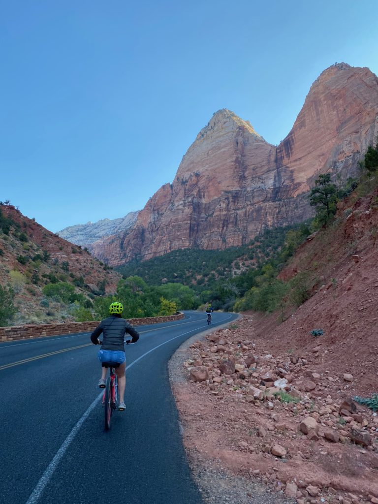
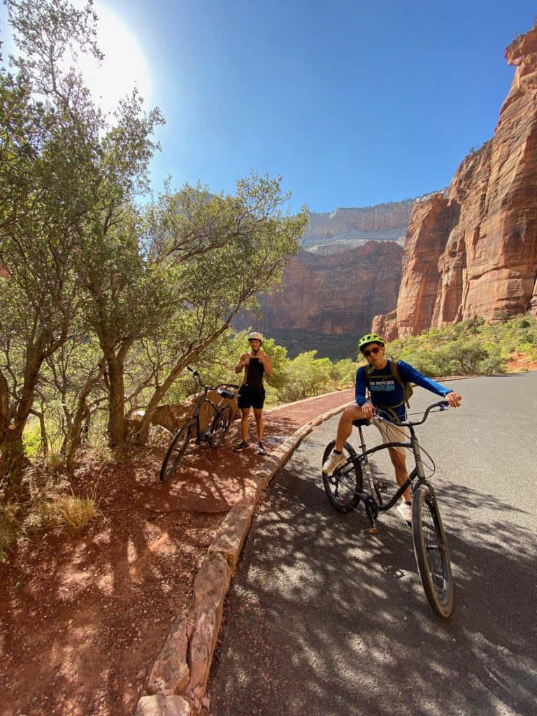
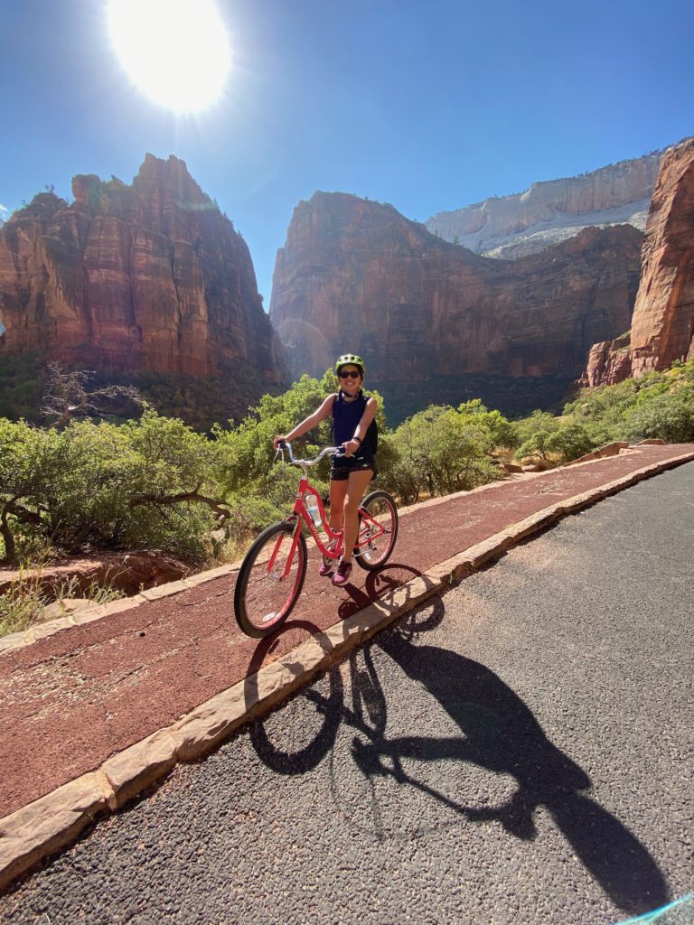
Biking
Personal cars aren’t allowed on the main scenic drive (to get out to hikes like Angel’s Landing and The Narrows), so the only way to get there is to take the Zion Shuttle. Last time we were here, we had a reasonably easy time just standing in line and getting on the shuttle, but this time, due to Covid, there was an online shuttle reservation system and because of limited capacity, it was really hard to get a shuttle ticket.
Instead, we ended up getting bike rentals and biking into the park which turned out to be an amazing experience!
We probably biked a total of just under 20 miles (it’s about 15 miles out to The Narrows which is the end of the Scenic Drive and back). It’s slightly uphill on the way in but mostly downhill on the way back. You can also put your bike on the shuttle at any point if you get tired, but we had a really great time just biking the whole way in and out.
Bike rentals: we ended up getting up at 5am to get bikes from Zion Outfitter which is first come first serve (they were sold out by 6:30am), but there are some other bike shops in Springdale that might be a bit further out and offer online reservations.
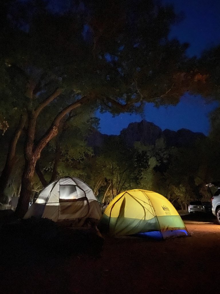
Camping
Last time, because it was so cold, we couldn’t camp and stayed at an Airbnb nearby, but the weather this time around in early October was perfect for us to camp two nights in Zion. We stayed at the South Campground (one of two open because of Covid), which had lovely views of the Watchman and was next to the Pa’rus Trail where we went on a nice post-dinner walk.
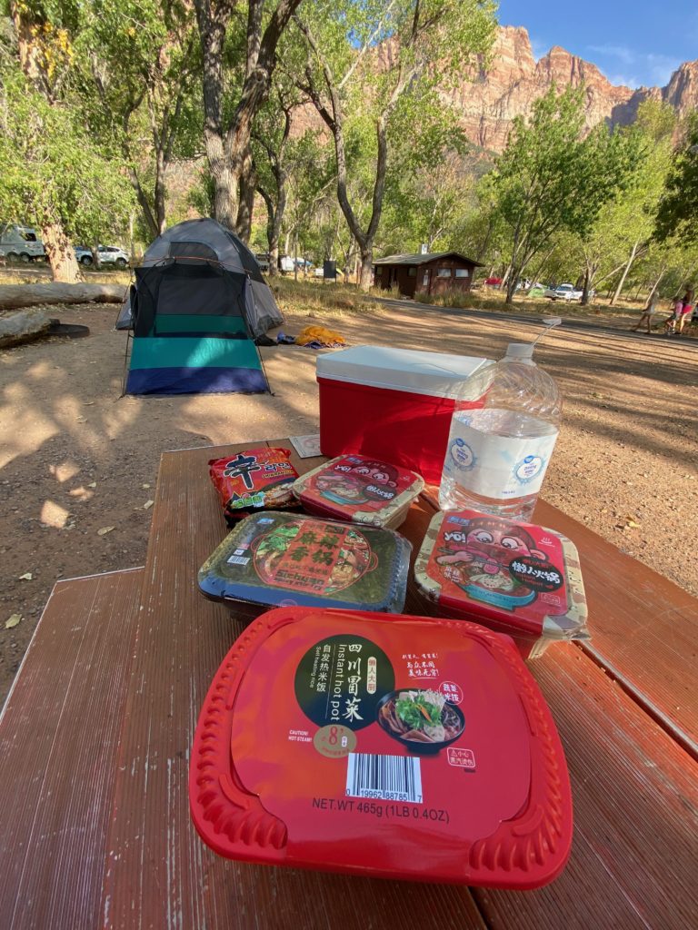
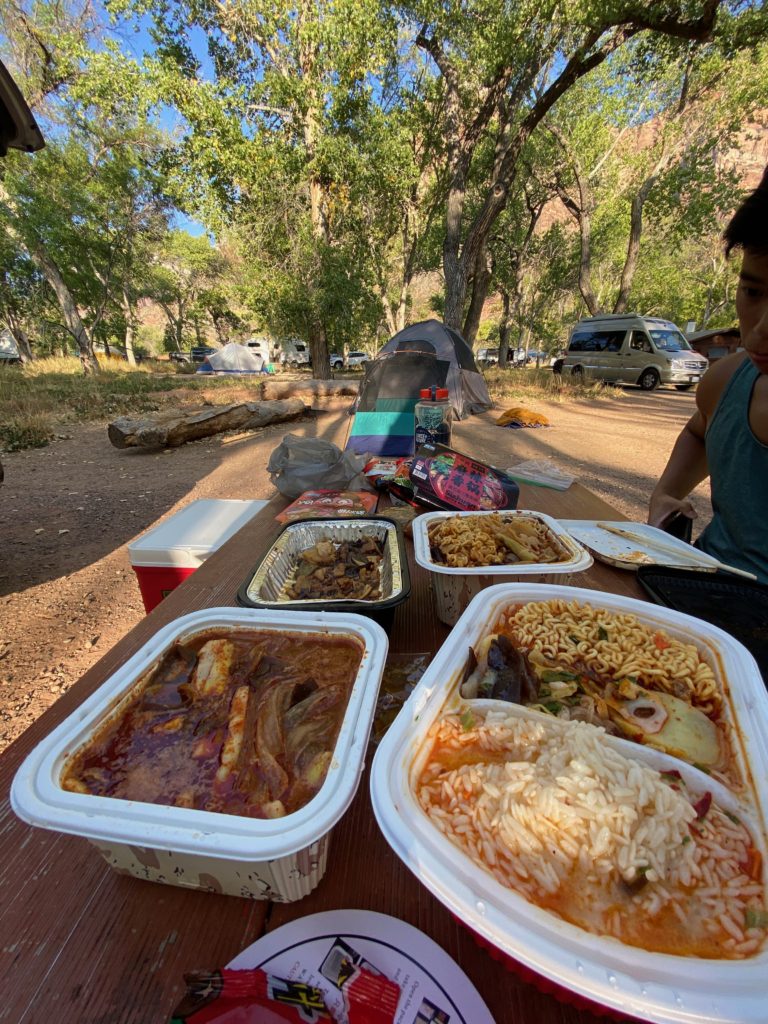
Our greatest discovery of this trip were these instant hot pot kits that we got at 99 Ranch in Las Vegas. You literally just add water and a chemical reaction set off in lower compartment of these containers heats up the hot pot. Our campsite smelled like mala spice for quite a bit afterwards, but it was a delicious dinner.
Campsite reservations: similar to the shuttle reservation system, there’s an online system to book campsites and especially on popular weekends, they go quick. Luckily, Roommate Willy is an experienced Coachella ticket buyer and was on the site right when reservations got posted 2 weeks before and booked us a campsite.
Until next time, Zion
The first time was great, but second was even better and if I can, I would definitely come again.
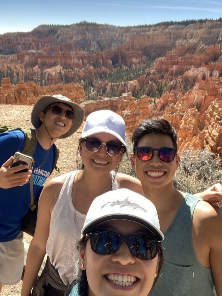
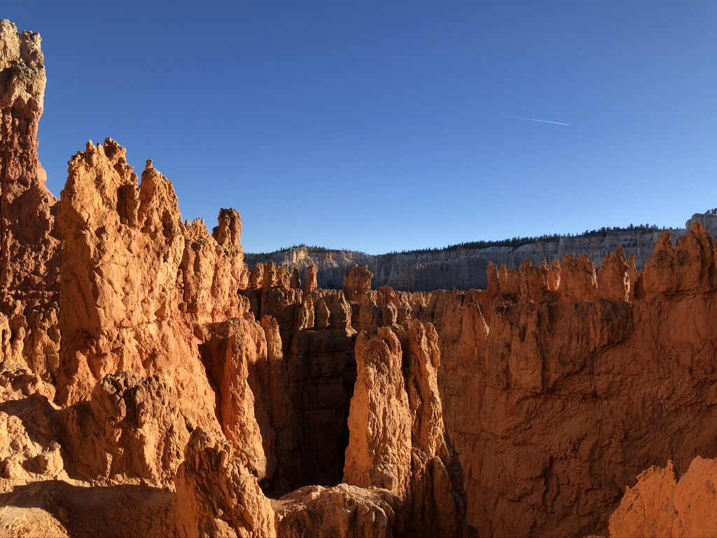
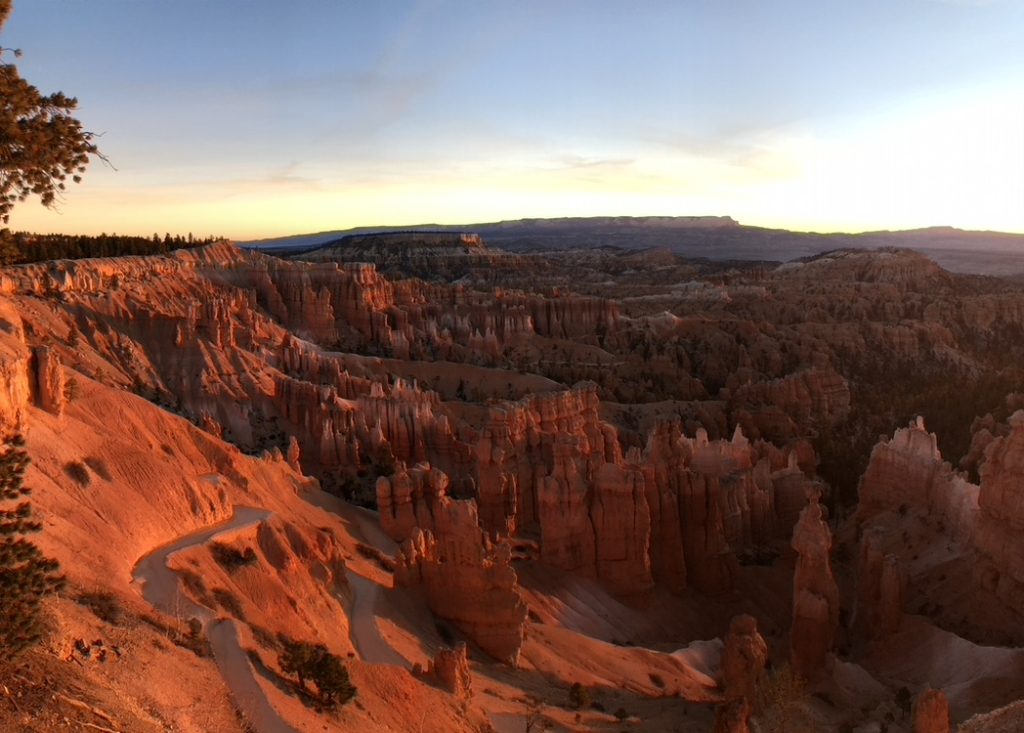
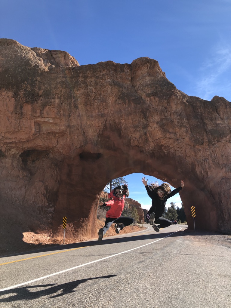
Bryce is one of the smaller of the national parks in the US and also not as frequently visited as its more popular neighbor Zion, but with its fun hoodoos and colorful red and orange rocks, it is easily one of my favorites. It’s about a 1.5 hour drive from Zion, so both times that I’ve visited Zion I’ve also tacked on a trip to Bryce.
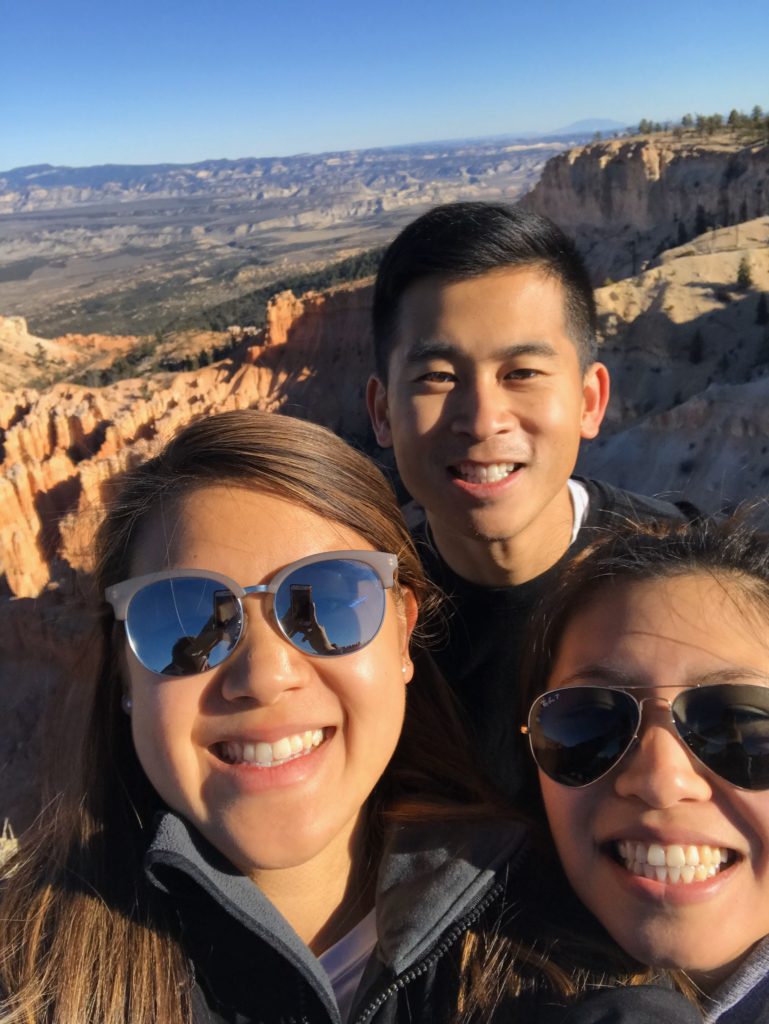
This trip, the Willys and Anna and I drove over to Bryce for a day in between camping at Zion. Last time I was here was two years ago when I third wheeled Dora and Jtran and spent about two days here before heading to Zion to meet up with Anna, Amy, and Margarita.
Left: me, Anna, and the Willys in Oct 2020 Right: me third-wheeling Dora and Jtran in Nov 2018
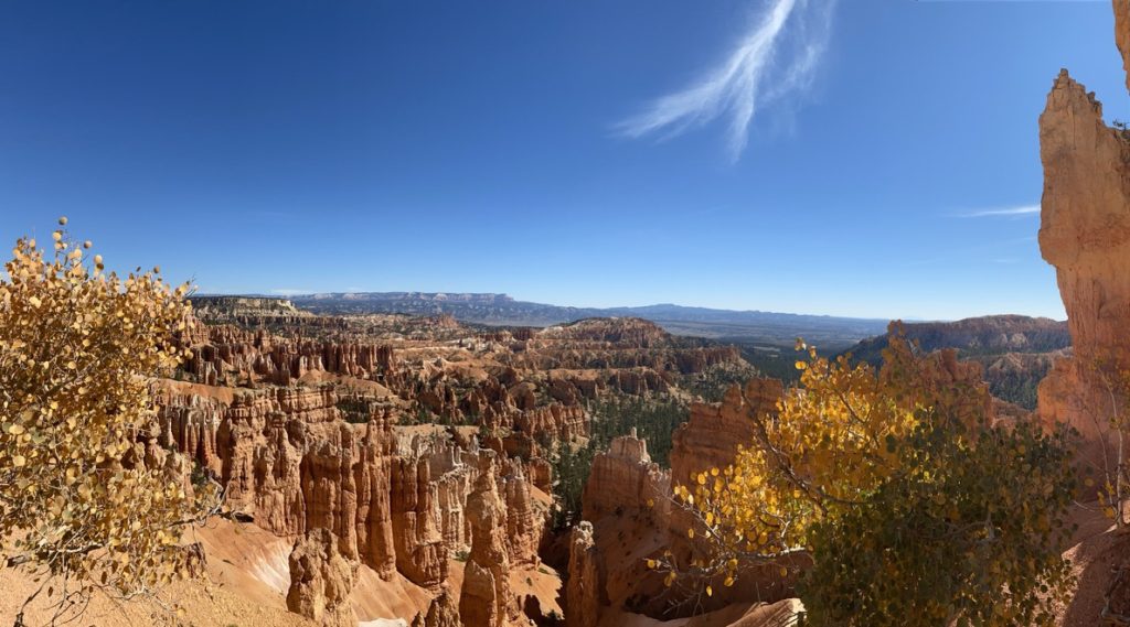
Rim Trail
There’s one trail that basically goes around the rim of the Bryce “amphitheater” that’s relatively flat, very easy to walk, and also will give you amazing views of the hoodoos all the way around. We saw lots of families and older people walking this trail, but it’s generally just a very fun and scenic one to walk or run.
Walking the rim trail along the “Amphitheater”
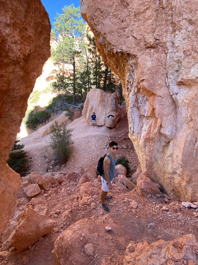
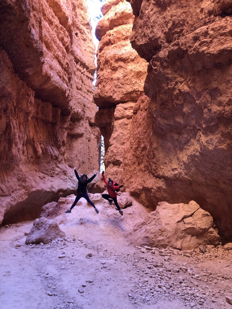
Queen’s Garden & Navajo Loop Trail
Queen’s Garden is probably the most popular trail in the park and had the most crowds both times I went, but it’s truly so spectacular because it allows you to walk through the hoodoos and see the rock formations up close from the top of the amphitheater down to the bottom.
The Willys and I in the “Navajo Loop” section of the trail in Oct 2020
There’s a pretty steep section called “Wall Street” that’s basically a set of really steep switchbacks that takes you down into the hoodoos, and last time Dora, Jtran and I did it in the afternoon almost around sunset and the light hitting the hoodoos made them look super cool.
Dora and I walking down “Wall Street” in 2018
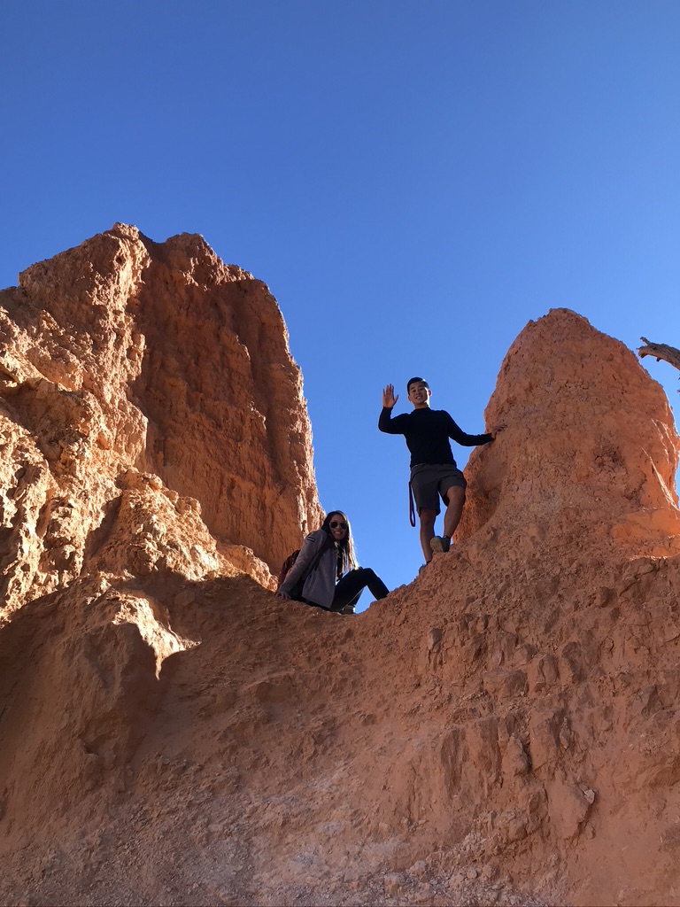
Peekaboo Trail
Because Dora, Jtran and I had more time in Bryce when we were here in 2018, we were able to do some longer hikes. Peekaboo Trail is in a further part of the park and therefore it was way less crowded.
The trail is called “Peekaboo” because you literally wind in and out of the hoodoos and around the amphitheater like a game of peekaboo. The views are great, we got to see lots of different landscapes, and is definitely worth it if you have more time in Bryce.
Sunset, Sunrise & Stargazing
Bryce is open 24 hours, so some of the best experiences in the park are after dark where there is amazing stargazing and also at sunset and sunrise.
When Dora, Jtran and I came in 2018, we stayed at a lodge right outside Bryce, so we were able to easily drive into the park after dinner to stargaze and also get up early in the morning to watch the sun rise before breakfast (though Dora had to drag Jtran and I out of bed).
Sunrise at “Sunrise Point” and “Sunset Point”
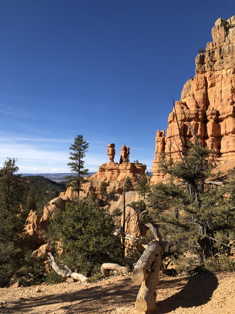
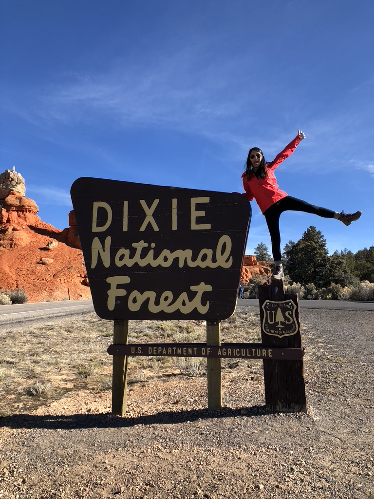
Dixie National Forest & More
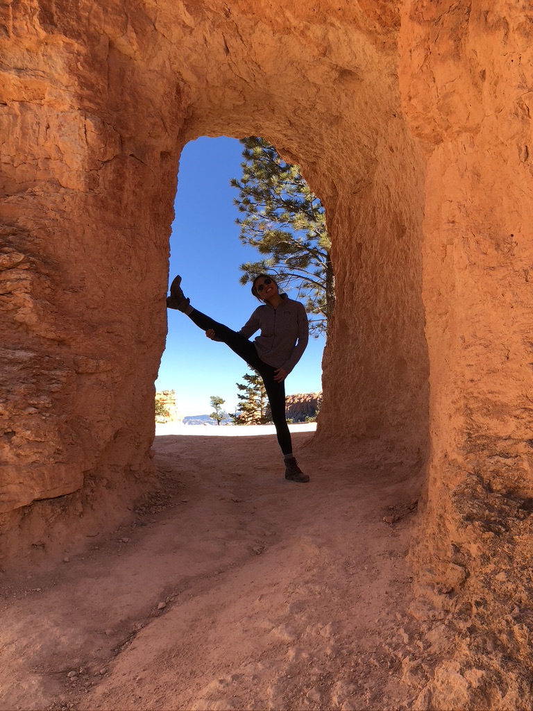
The drive from Zion to Bryce was actually super scenic and the later part included a drive through Dixie National Forest which also had a fun, short hike that we did on the way out. If you have additional time and want to spend more time in the area, it’s definitely fun to make a stop in Dixie or at this cool arch that you pass through.
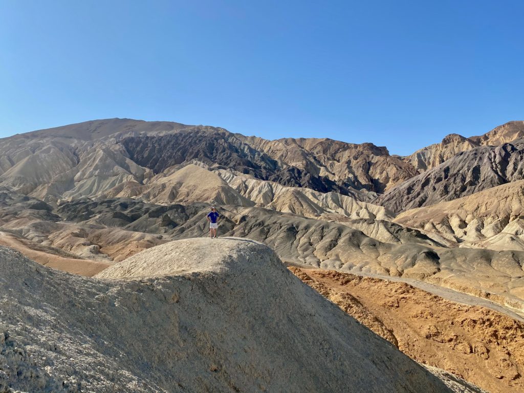
I was super excited about Death Valley because it is where most of the Tatooine scenes from Star Wars were filmed. Our original plan was to camp in the park, but even in October, the temperatures are up in the 100s and only come down to lows around the 80s at night (which would’ve made for a very toasty camping experience), so we just did a day trip from Las Vegas. Only having a day meant that we weren’t able to see some of the more remote parts of the park (like Racetrack Playa which is a 1+ hour drive from the park entrance), but regardless we were satisfied with our day in Tatooine.
Dante’s View
This was our first stop of the day and was about a 30 min drive one way just to get out to this viewpoint. There isn’t much of a hike, mostly just a walk from the parking lot but it was worth getting the view from above Badwater Basin (which is the lowest point in North America and which we will visit later)
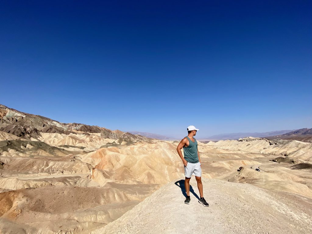
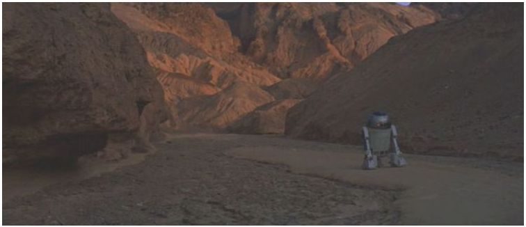
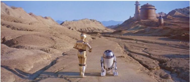
Twenty Mule Team Canyon
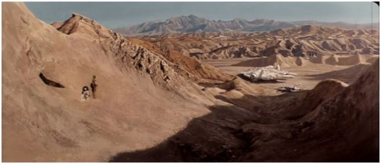
This hike might not otherwise have been that exciting for the average person, but I was super excited to do this because many scenes from Star Wars were filmed here.
Check out our photos versus a scene from A New Hope:
R2 and C3PO in Star Wars: A New Hope
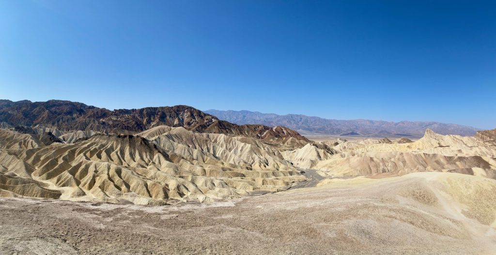
Zabriskie Point
This is probably the most visited point in the whole park. The views were cool, but it probably only took us 10-15 minutes to park, walk up the paved path, and look around. There are some hikes around here but we didn’t do them because we thought they were similar to the ones in Twenty Mule Team Canyon.
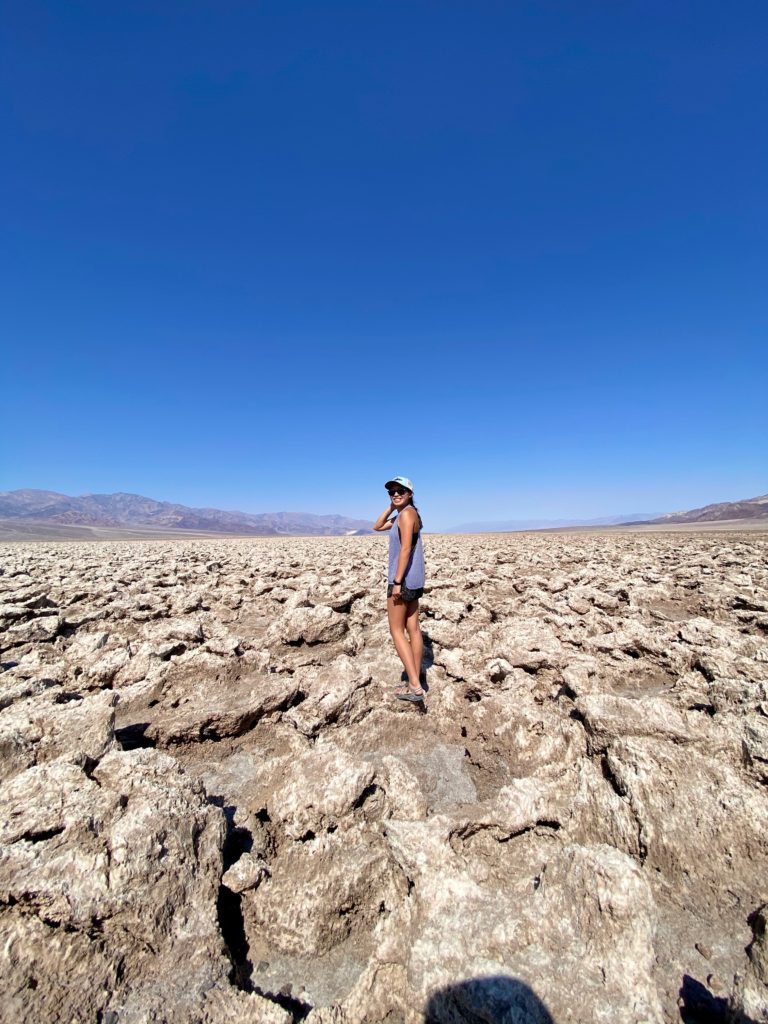
Devils Golf Course
We took a quick stop at Devils Golf Course on the drive out to Badwater Basin. It’s basically a huge expanse of salt crystals that have formed into cool formations. Willy licked the crystals – they’re salty, but sharp, and probably would be painful if we fell on them!
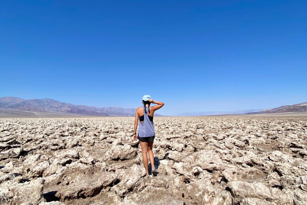
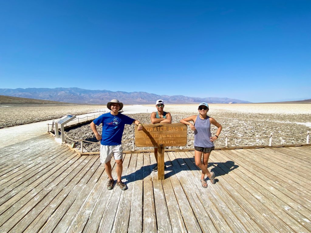
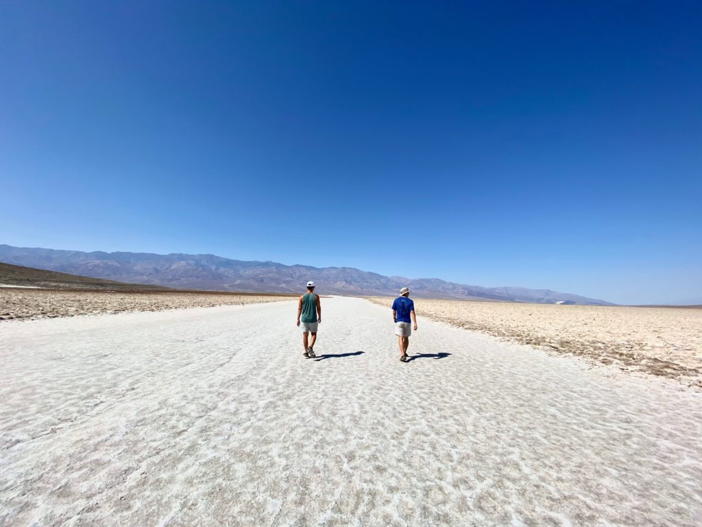
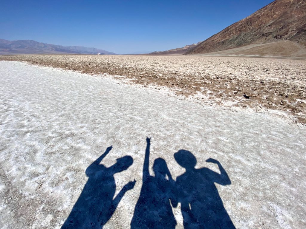
Badwater Basin
The lowest point in the United States & North America at ~300 ft below sea level! This is basically a huge salt flat and looks super cool (but it was SO HOT we could only manage to walk around for a few minutes before escaping back to our air conditioned car)
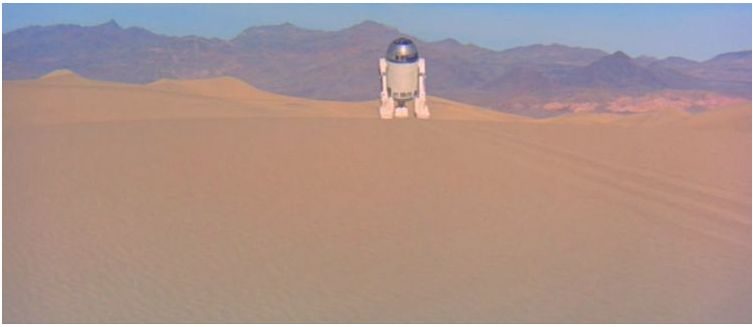
Artist’s Drive & Artist’s Palette
This was another fun drive and relatively short hike up to Artist’s Palette which features these cool, colorful rock formations. This area was also used in a couple scenes in Star Wars:
R2-D2 in Star Wars: A New Hope
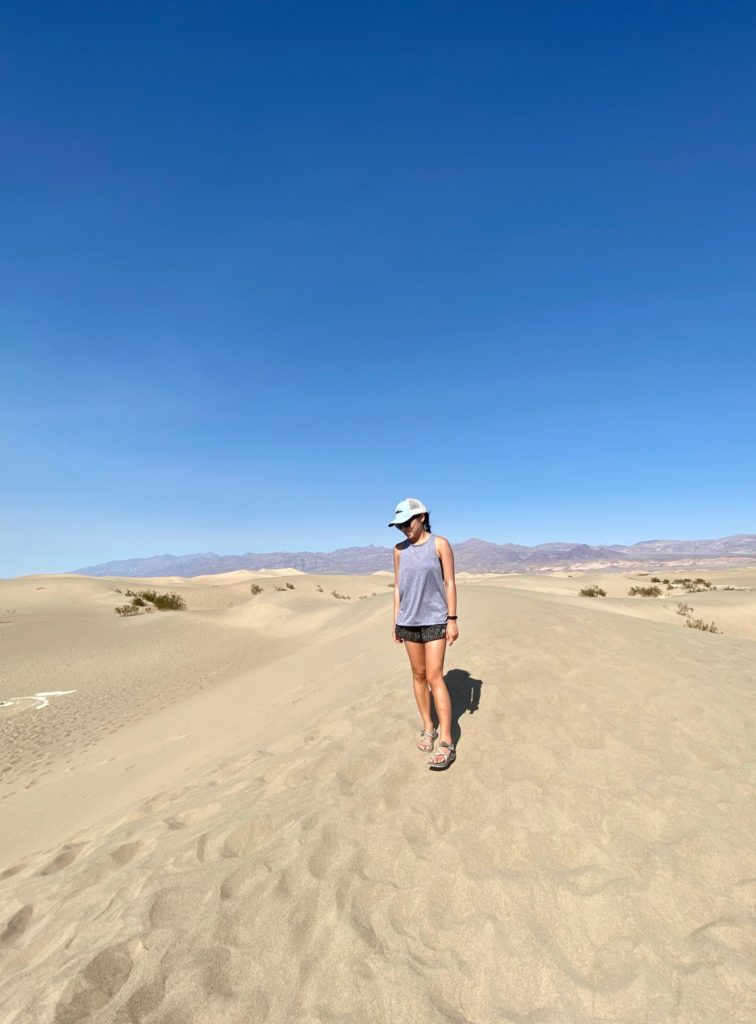
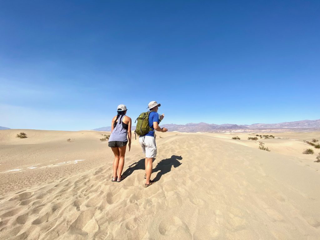
Mesquite Sand Dunes
I didn’t really realize there were sand dunes in Death Valley, but this was a cool stop because in the middle of all these vast rock formations and salt flats, there’s just a huge mass of sand. Here are Willy and I trying to be R2 and C3PO:
These aren’t the droids you’re looking for
That’s a wrap!
Cheers to a fun (and hot) day in Tatooine, er, Death Valley!